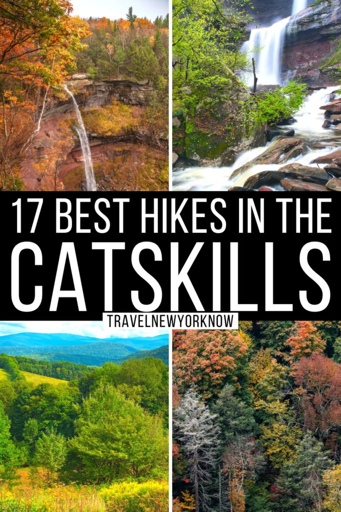
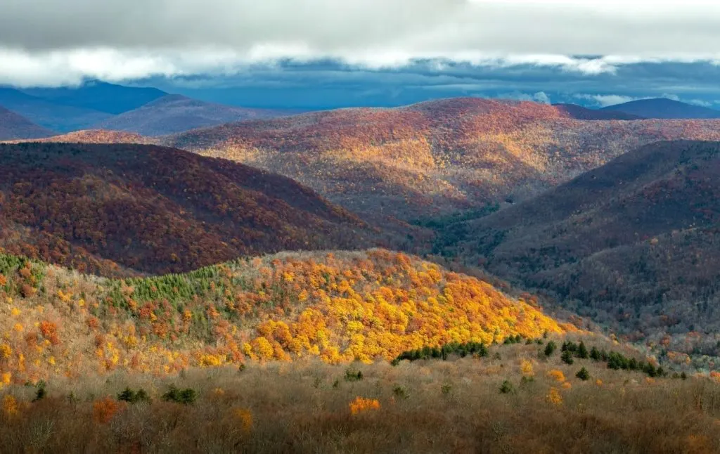
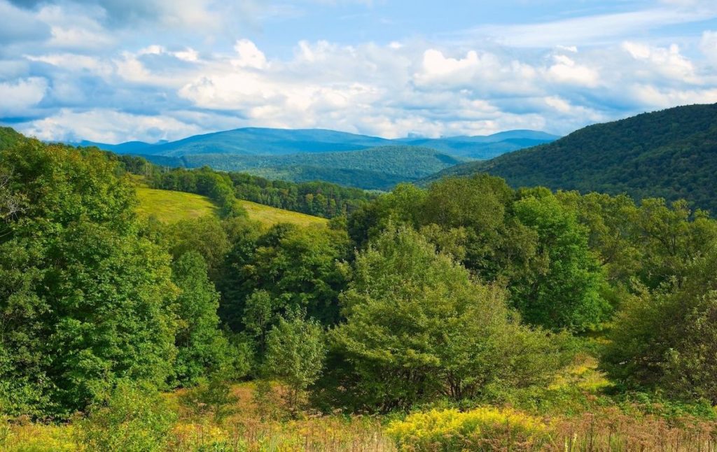
Ain’t no party like a Catskills hiking party, am I right? In all seriousness though, the Catskills is a stunning part of New York state that is home to quite literally thousands of miles of hiking trails – day hikes that will take you to secret ice caves, hidden lakes, long-forgotten ruins, remote airplane crashes, and awe-inspiring waterfalls.
So, if you’re not lacing up your boots right now and checking out some of the best hikes in the Catskills, then you really should be. Because regardless of your skill level, there really is a hike on this list that will perfectly fit your needs.
After all, I grew up in the Hudson Valley and the Catskills was basically like my unofficial backyard. Therefore, after 30+ years of experience, I know all about the best hiking trails in the Catskills that you cannot afford to miss.
Therefore, grab a handful of delicious trail mix and get ready to swan dive into this epic list of the best day hikes in the Catskills – at least if you want to quickly and easily plan the outdoor Catskills getaway of your dreams.
This post may contain affiliate links. Please see my disclosure for more information. As an Amazon Associate, I earn a small commission from qualifying purchases.
Table of Contents
Best Easy Hikes in the Catskills
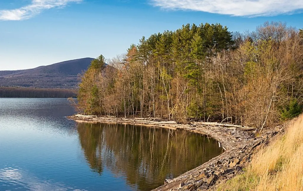
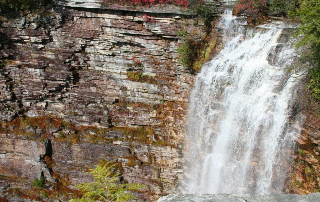
1. Kaaterskill Falls Hike
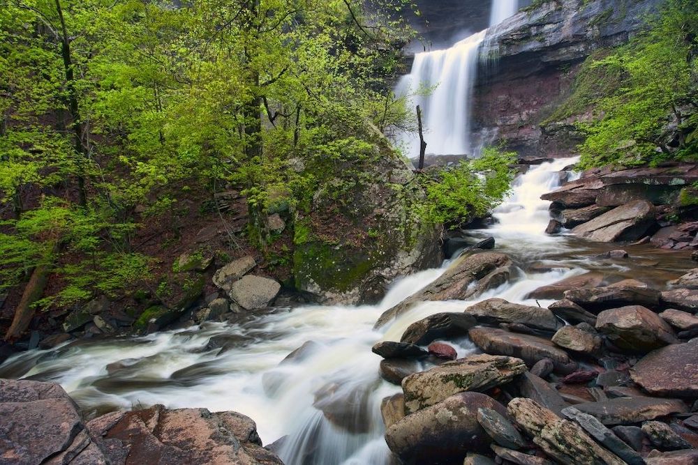

This is one of the best hikes in the Catskills that rewards you with an epic view of, you guessed it, Kaaterskill Falls at the conclusion of your trek.
And that’s pretty dang sweet since this waterfall stands at a hefty, 260 feet tall and consists of two smaller waterfalls – the 85-foot tall lower falls and the 175-foot tall upper falls.
So, just rock out along a short and sweet, 0.5-mile hike that will bring you along a well-marked trail directly to the waterfall viewing platform.
And while there are many different parking lots for this hike, try to nab a spot in the largest parking lot at the end of Laurel House Road (off of North Lake Road).
Sure, you won’t be able to see Bastion Falls along the way. But, you can always see that waterfall from Route 23A instead.
Pro Tip: Per usual, go early to avoid crowds and a totally full parking lot. Also, try and visit in the spring since this waterfall can dry up in the summer.
Location: Haines Falls
Distance: 1.6 miles
Difficulty: Easy
Route: Out and Back
Elevation Gain: 396 feet
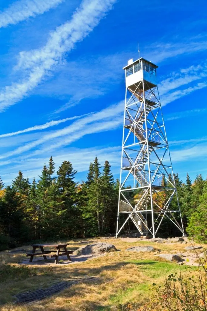
2. Overlook Mountain

Located near good old Woodstock, NY (right across the street from the monastery), this is one of the best hikes in the Catskills that pretty much everyone in the family will enjoy.
I mean, it’s not s super challenging hike but still boasts some of the best views in the Catskills from the summit. So, after you park at the trailhead, follow a gravel road for about 2 miles until you hit the summit.
At this point, you’ll stumble across some pretty cool ruins that are all that remain from a former hotel in the area, as well as a fire tower that you should definitely climb to the top of.
If you can, pack a picnic lunch so that you can eat at one of the picnic tables on the summit. Also, be on the lookout for the remains of a plane crash in the area.
Pro Tip: This hike is best done between April and November. You’ll also want to get here early since the parking lot is small and fills up fast.
Location: Woodstock
Distance: 4.8 miles
Difficulty: Easy
Route: Out and Back
Elevation Gain: 1,397 feet
3. Catskills Scenic Trail
Don’t let the length of this trail intimidate you because this is an incredibly even, easy-to-use, well-paved area that is perfect for the entire family.
In fact, you can ski, bike, or hike your way across one of the best hikes in the Catskills that was formerly used by the Ulster and Delaware Railroad.
Yup, this former railway track was converted into a super flat surface that can now be used for outdoor recreation all year long. Plus, there are also various access points all along the route so you can walk as little or as much of the trail as you like.
So, feel free to begin your hike from either the Railroad Avenue trailhead in Stamford or the Route 10 trailhead in Bloomville and enjoy one of the best hiking trails in the Catskills as you follow either the yellow or blue octagon-shaped trail markers along the way.
Location: Bloomville
Distance: 24.9 miles
Difficulty: Easy
Route: Out and Back
Elevation Gain: 780 feet (very gradual
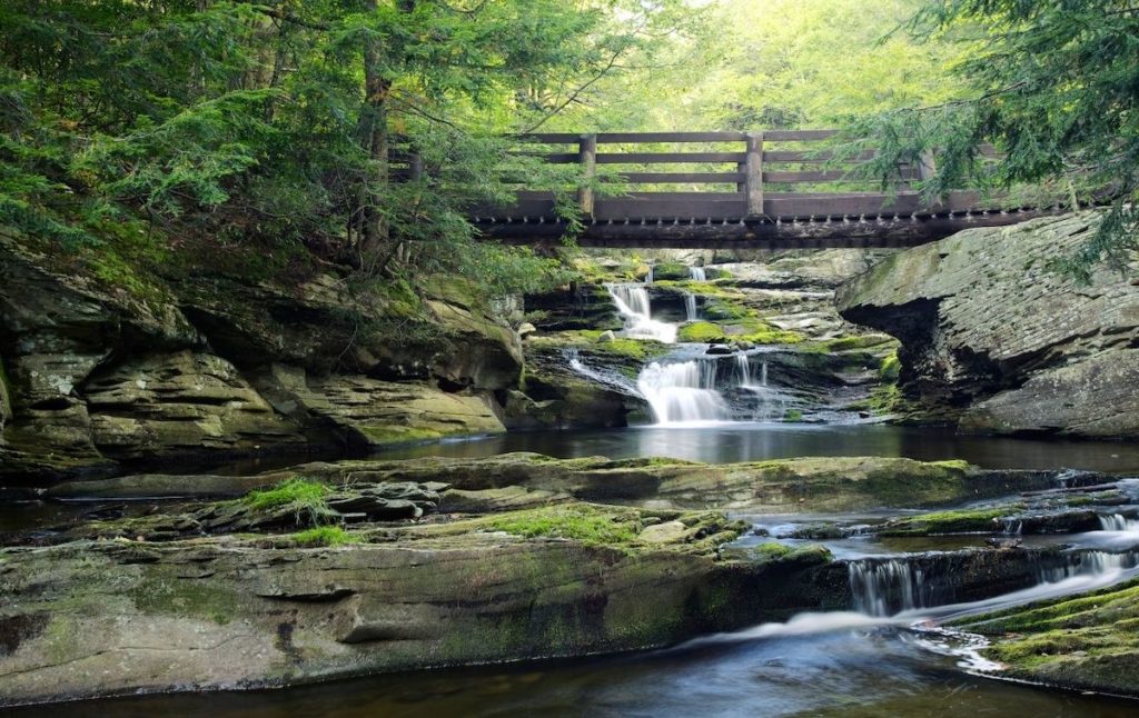
4. Frick Pond Loop
This is one of the best hikes in the Catskills that can be found within the Willowmec Wild Forest, a 14,800-acre preserve that features an amazing, 40-mile network of trails.
So, if you would like to use one of the many best hiking trails in the Catskills, just access the hike from the parking lot on the left-hand side of Beech Mountain Road.
Once here, look for the Quick Lake/Flynn trail trailhead and follow the red blazes for 0.2 miles until you see the trail register. Keep left on the Quick Lake Trail and then stay left at the Gravestone Junction.
Next, walk down the hill to a bridge where you can take some gorgeous photos of the area’s beautiful views.
Go across the bridge and continue around the pond, eventually bearing right at an inspection onto the Big Rock Trail with its yellow blazes.
Finally, when you get to the four-way junction, turn right onto the Loggers Loop Trail (more yellow blazes) and finish the loop around the pond. You’ll then turn left onto the Quick Lake Trail (red blazes) and can easily make your way back to your car.
Pro Tip: Because there are wooden boardwalks across the muddiest sections of the trail, they can get quite slippery when it rains. So, be sure to wear waterproof shoes with great traction.
Location: Livingston Manor
Distance: 2.2 miles
Difficulty: Easy
Route: Loop
Elevation Gain: Almost none.
5. Ashokan Rail Trail
Recently opened in the fall of 2019, the Ashokan Rail Trail (or ART for short) is one of the best trails in the Catskills for families who are basically looking for a nice, leisurely stroll through the woods.
That’s because this is an incredibly flat, wide (between 10 and 12 feet), well-paved, multi-use path that stretches from the Ashokan Reservoir all the way to Basin Road in West Hurley and Route 28A in Boiceville.
So, even though the mileage on this hike may look high, there are multiple access points along the route – the Woodstock Dike Trailhead, the Ashokan Station trailhead, and the Boiceville Bridge Trailhead – making it easy to hike as much of the trail as you like.
Plus, if you don’t feel like walking, you can always bike, snowshoe, or ski your away across the trail too.
Pro Tip: There are also plenty of benches along the trail so it’s easy to stop along the way and savor some of the best views in the Catskills.
Location: West Hurley
Distance: 23.3 Miles
Difficulty: Easy
Route: Out and Back
Elevation Gain: 711 feet
6. Neversink River Unique Area
The Neversink River Unique area has a lot of very interesting trails with different levels of difficulty. My personal favorite is the one that takes you along the river. It is an easy trail and is great for people who love to fish! It is great if you like to camp too!
Did I mention that this trail allows you to take dogs along too? So you don’t need a pet sitter. Just take the fur babies along and let them stretch their legs. Just make sure that you take their leash. They won’t be allowed in otherwise.
The area has a lovely gorge, numerous waterfalls and it even has a trail where you can take an ATV. The Neversink River Unique area does have something for everyone. In fact, since it has so many trails, you could spend numerous days exploring each one of them. All of the trails have spectacular views!
Pro tip: It is important to know that cell service here is really bad. Make sure you take a pic of the route before starting off and don’t rely on GPS for navigation.
Location: Cuddebackville
Distance: 5.4 miles
Difficulty: Easy
Route: Out and back
Best Moderate Hikes in the Catskills
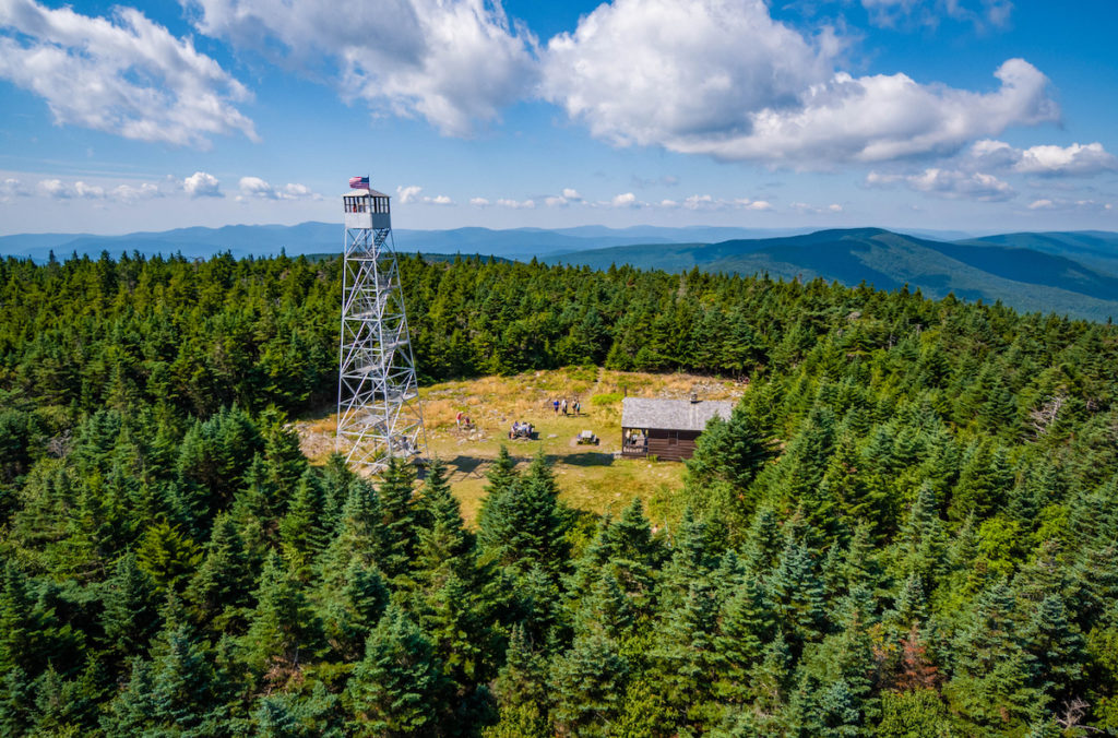
7. Balsam Lake Fire Tower

Standing at an impressive 3,731 feet tall, Balsam Lake Mountain has the distinction of being the 17th tallest peak in the Catskill mountain range and one of the best hikes near NYC.
Therefore, it’s no surprise that this majestic mountain – complete with a 47-foot tall fire tower at the summit – is home to some of the best views in the Catskills and some of the best hikes in the Catskills too.
So, if you want to give this exceptionally wonderful hiking trail in the Catskills a try, head over to the trailhead on Mill Brook Road.
It sits inside the 13,500 acres Balsam Lake Mountain Wild Forest and follows along the old fire road that was once used to get to the top.
Keep an eye out for the blue blazes that mark the Dry Brook Ridge Trail and follow that until you hit a junction at the 2.25-mile mark.
Keep right at this intersection and continue through a gate that prevents cars from using the path. The trail will get progressively steeper and you’ll eventually hit a sign that indicates you’ve reached 3,500 feet in elevation.
After this point, you only have 200 more feet of elevation gain until you reach the cabin and fire tower at the summit.
Pro Tip: Be sure to visit the top of the fire tower before you leave for some of the best views in the Catskills. Just note that the fire tower and cabin here are only open in the summer.
Location: Arkville
Distance: 6.0 miles
Difficulty: Moderate
Route: Out and Back
Elevation Gain: 1,100 feet
8. Diamond Notch falls via Spruceton Road
The Diamond notch falls is a great trail near West Kill that is a popular favorite since it is both easy to access and is moderately challenging. The beauty of the trail is one of the big draws. I mean you get to see a gorgeous waterfall, catch a swim in the cool clear water and despite the crowds the area is remarkably peaceful!
In fact, this is one of the kid friendly hikes that comes highly recommended. You can even take your dogs with you as long as you ensure that they are on a leash. Oh and as I mentioned before, the route is popular so start out early so you avoid the crowds.
Pro tip: The best time to visit Diamond Notch falls is between March to November.
Location: Spruceton Road, Lexington, NY
Distance: 1.7 miles
Difficulty: Moderate
Route: Out and back trail
Elevation gain: 300ft
9. North Point

Tucked away inside the Windham-Blackhead Range Wilderness Area, this is one of the best hikes in the Catskills that is best used between April and October.
It’s a short but sometimes intense climb that starts on North Lake Road in the North/South Lake Campground. From here, turn left at the first junction in the trail and then make a hard left at the second intersection, being sure to follow the blue trail markers as you use boardwalks to traverse boggy areas.
You’ll continue up a section of steep rock until the trail levels out into a dirt path. You’ll then make your way over a series of ledges before everything flattens out and you reach the summit, which is home to some of the best views in the Catskills.
Also, just an FYI, the trail to Kaaterskill Falls sits just outside this campground and can easily access from the trailhead at Route 23A.
Pro Tip: There are tons of different hiking trails in the area. So, you can always do a shorter hike to the Catskill Mountain House or a longer hike to either Sunset Park or Boulder Rock. Also, to avoid a day-use fee, skip parking in the North-South Lake Campground parking lot and leave your car just outside the park in a lot right across the street.
Location: Haines falls
Distance: 3.0 miles
Difficulty: Moderate
Route: Out and Back
Elevation Gain: 797 feet
10. Bramley Mountain Trail
Best used between April and November, this trail was recently created by the Catskill Mountain Club and takes you to the summit of Bramley Mountain, which sits at a respectable 2,817 feet in the air.
Therefore, start at the trailhead on Glen Burnie Road and take that for about a mile. Once here, you can admire a stunning bluestone quarry that now sits abandoned and then continue past hardwood forests, small caves, enchanting cliffs, and old stone walls.
Next, descend to the Summit Trail, which is about 1.8 miles long and takes you on a direct path to the mountain’s summit with its stellar views of Mount Pisgah and the Pepacton Range.
Location: Delhi
Distance: 3.8 miles
Difficulty: Moderate
Route: Loop
Elevation Gain: 898 feet
11. Hike to High Falls, Denton Falls, and Mullet Falls in the Neversink River Unique Area

This gorgeous, well-marked, loop trail starts at the trailhead on Katrina Falls Road. It’s here that you’ll find a wide dirt path at the end of the parking lot.
Jump on this path and follow the blue blazes over several backcountry bridges, being sure to make detours to off-shooting foot trails to the banks of the Neversink River, Denton Falls, High Halls, and Mullet Falls.
You’ll also encounter many ups and downs along the way, but this is one of the best hikes in the Catskills that is easily worth all the effort.
Plus, once the blue blazes have ended, you can just go back the way you came and follow the red blazes on your right to complete the loop.
Also, this is one of the best hiking trails in the Catskills that can get really wet and muddy. So, waterproof shoes are an absolute must for anyone doing this hike.
Pro Tip: This is one of the best hikes in the Catskills that you should attempt during the summer so that you can go for a swim at High Falls. Also, the parking lot at the trailhead is super small and there are a ton of “no parking signs” all over the place. Therefore, try to get here early in the day before the lot fills up.
Location: Rock Hill
Distance: 8.4 miles
Difficulty: Moderate
Route: Loop
Elevation Gain: 1,663 feet
12. Vernooy Kill Falls Trail
This enchanting trail will take you on a mildly difficult hike from the trailhead on Upper Cherrytown Road all the way up to the top of Cherrytown Mountain.
To start one of the best hikes in the Catskills, just head to the aforementioned trailhead of awesome and follow the blue blazes that denote the Long Path. Continue for around 1.8 miles until you reach a bridge that sits beneath the falls.
Once here, you can admire the stunning swimming holes and waterfalls that proliferate throughout the area, like the one and only Vernooy Kill Falls.
It’s basically a 60-foot tall cascading waterfall that tumbles down a series of shale ledges. As a result, there are some deep pools beneath the falls that make for an ideal swimming spot in the summer.
FYI, when I say waterfall, it’s not really one giant waterfall but rather a series of smaller rapids that when looked at together form one waterfall. Yeah, just putting that out there so that you’re not disappointed when you finally get here.
Pro Tip: Spend time hiking along both sides of the waterfall and don’t forget to visit the ruins from the old mill here. You can also get a great photo of the bridge and falls by standing on the rocks in the center of the stream. Just be careful not to fall in.
Location: Kerhonkson
Distance: 3.5 miles
Difficulty: Moderate/Easy
Route: Out and Back
Elevation Gain: 656 feet
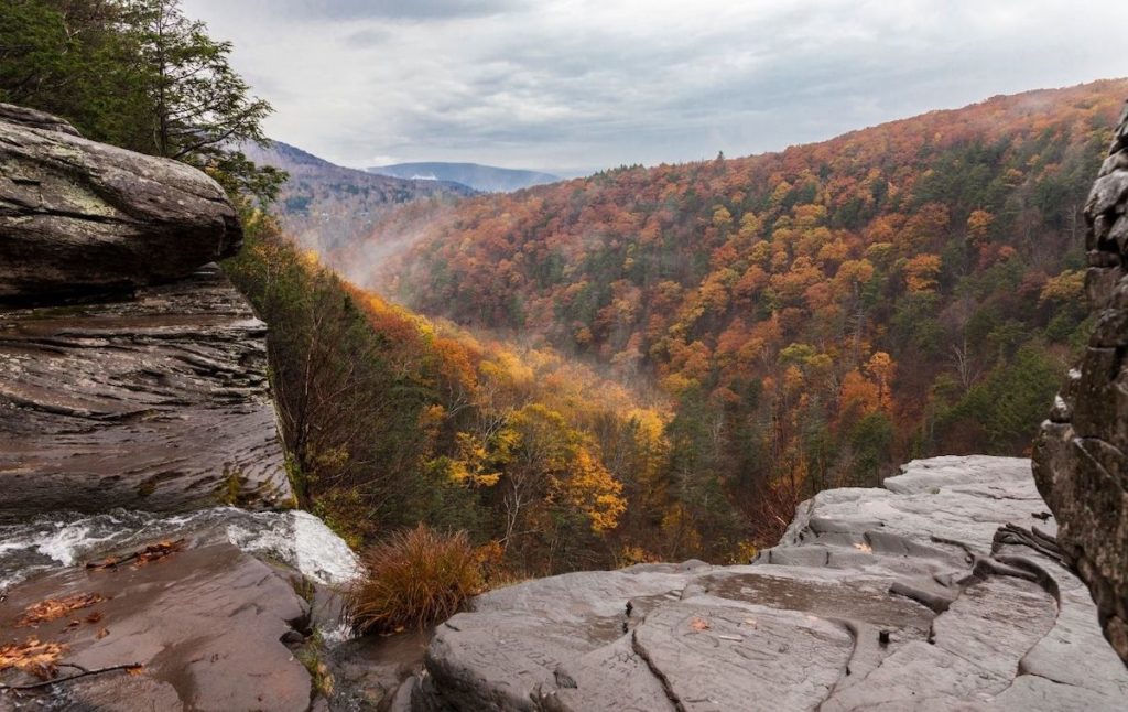
13. Verkeerderkills Falls + Sam’s Point

You’ll find this rad hike of awesome in Minnewaska State Park, just outside of New Paltz.
And although you will have to shell out a solid $10 for a day pass, this is one of the best hikes in the Catskills that is well worth the small price tag.
So, leave your car at the lot right by the visitor’s center and choose between a 5.6-mile hike or an 8.6-mile hike that will take you through Sam’s Point too!
Personally, I’d go with the longer trail so that you can enjoy some sweet views from Sam’s Point. But, regardless of the route you choose, you’ll be treated to delightful panoramas of the 200-foot tall, Verkeerderkills Falls.
And, added bonus, you’ll pass by some neat ice caves and some secret lakes too. Sadly though, the Ice Cave Trail isn’t open throughout the winter like you might expect.
It also consists of a pretty intense hike that includes stairs, ladders, and wooden bridges that will finally take you to the largest exposed fault system in the USA.
So, what are you waiting for? Do one of the best day hikes in the Catskills in the spring so that you can marvel at High Point Monument, Verkeerderkill Falls, the Ice Caves (they’re frozen all year long), and Historic Berry Picker Shacks (from when people once picked blueberries here).
Pro Tip: Come early or on a weekday to avoid the disaster that is the parking situation here.
Location: Minnewaska State Park Preserve/New Paltz
Distance: Between 5.6 and 8.6 miles
Difficulty: Moderate
Route: Out and Back
Elevation Gain: 994 feet
14. Huckleberry Point Trail
What I love about Huckleberry Point Trail is that it’s perfect for hikers of varying skill levels – allowing them to come together and enjoy one of the best hiking trails in the Catskills.
After all, this popular trail is fairly short and isn’t too terribly difficult. However, there are a few extremely steep sections that more advanced hikers will enjoy. Plus, you can’t really beat the panoramas at the end which are easily some of the best views in the Catskills.
So, if you want to try one of the best hikes in the Catskills, just drive to the trailhead on the left side of Platt Clove Road and park your car in the lot there.
Once you have your gear ready to go, just follow the blue blazes up the hill for a few minutes. Then, instead of continuing straight, follow the yellow trail sign to the right.
Continue hiking with those yellow blazes through streams, along varied terrain, and up some steep inclines until you reach Huckleberry Point. Trust me, you can’t miss it since you’ll be gobsmacked by incredible views of the Hudson River on your left and the Catskills on your right.
Pro Tip: Although rare, bears sometimes stop by when the Huckleberry bushes are in season. So be aware of that before hiking this trail.
Location: Elka Park
Distance: 4.5 miles
Difficulty: Moderate
Route: Out and Back
Elevation Gain: 1,151 feet
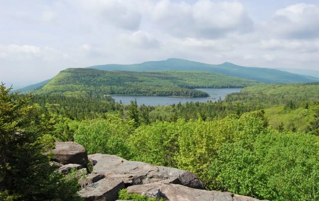
15. Giant’s Ledge Catskills and Panther Mountain

This popular day hike in the Catskills offers intrepid climbers sweeping views from five different ledges that come together to form the Giant Ledge area.
And although this hike is a modest, 3 to 4-mile climb, the trail itself is incredibly steep. So, be sure to wear the right gear and definitely come prepared for a bit of a workout (read, bring lots of water).
However, if you need a night to rest and recuperate your weary self then you can always make use of one of the campsites in the area.
Otherwise, you can push on and go another mile up the trail to the summit of Panther Mountain for some of the best views in the Catskills.
Location: Big Indian
Distance: 6.3 miles
Difficulty: Moderate
Route: Out and Back
Elevation Gain: 1,981 feet
Best Difficult Hikes in the Catskills
16. Mount Tremper

The mountain formerly known as Timothy Berg is a 2,740- foot tall mountain that quietly sits in between Ashokan High Point and Overlook Mountain.
It’s also one of the best hikes in the Catskills that is fairly difficult so if you’re up for an intense climb, then you can catch the red trail from the trailhead on Old Route 28, near Esopus Creek.
Once on the hike, you’ll traverse two wooden bridges and then climb a rock staircase (at around 0.4 miles) before hitting a junction with a sign-in station. Turn right here and start climbing back and forth. up the mountain.
Along the way, you’ll discover lots of wide roads since this was once a major logging area. About two miles in, you’ll also see the Baldwin Memorial Lean-To.
Keep going for another mile or so and you’ll eventually find both the Temper Mountain Lean-To and a 47-foot tall fire tower on the summit.
Take time to admire sweeping panoramas of Plattekill, Indian Head, Plateau Mountain, and Wittenberg from the top of the fire tower before descending the way you came.
Pro Tip: Because of years of mining, this place is now a popular hang-out for local rattlesnakes. So, be mindful of these extremely poisonous creatures when using one of the best trails in the Catskills.
Location: Phoenicia
Distance: 6.0 miles
Difficulty: Difficult
Route: Out and Back
Elevation Gain: 2,027 feet
17. Hunter Mountain Fire Tower (via Becker Hollow)
Because Hunter Mountain stands at a solid, 4,040 feet tall, it’s actually the second tallest peak in all of the Catskills (second only to Slide Mountain, just in case you were wondering).
Therefore, any hike up this behemoth mountain is sure to be a challenge. But the Becker Hollow Trail happens to be especially difficult since it’s actually the steepest trail to the summit.
So, if you want to discover one of the most intense and best hikes in the Catskills, access the trailhead near a large stone gateway and a kiosk about a mile south of Route 23A.
Once here, follow the blue blazes for around 2.2 miles until you see an intersection. Hop on the yellow-blazed trail to Hunter Mountain and do a half-mile hike to a 60-foot tall fire tower, a ranger station, and a picnic table.
And when you finally hit the summit, just sit back, relax, and enjoy some of the best views of the Catskills as you take in the sight of West Kill, North Dome, Sherrill, Balsam, Vly, and Bearpen in the distance.
Pro Tip: After enjoying one of the best hiking trails in the Catskills, be sure to see the site of the original tower. It sits on a blue trail about a quarter-mile behind the ranger station/cabin. You can also camp for three nights or less (otherwise you need a permit) at one of the two lean-to shelters in the area.
Location: Hunter
Distance: 5.5 miles
Difficulty: Difficult
Route: Out and Back
Elevation Gain: 2,240 feet
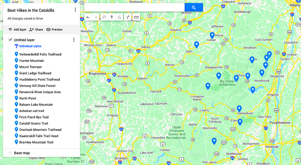
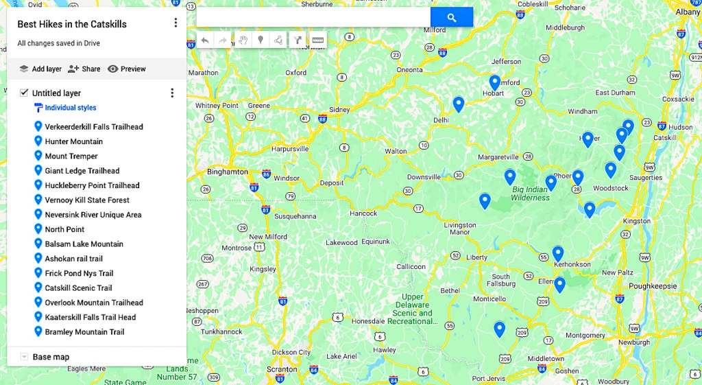
Map of the Best Hikes in the Catskills
Additional New York Travel Resources You’ll Love
- Best Hikes in the Adirondacks
- Best Winter Hikes in New York
- Best Hikes in New York State
- Best Hikes in Upstate New York
- Best Caves in New York
- Best Hikes in the Hudson Valley
- Best All-Inclusive Resorts in the Catskills
There you have it! That just about wraps up my guide to all of the best hikes in the Catskills!
Tell me, did your picks for the best hiking trails in the Catskills make the cut? If not then let me know in the comments below.
And if you found this post on the best day hikes in the Catskills useful, be sure to join our email list before pinning this post now so that you can read it again later!