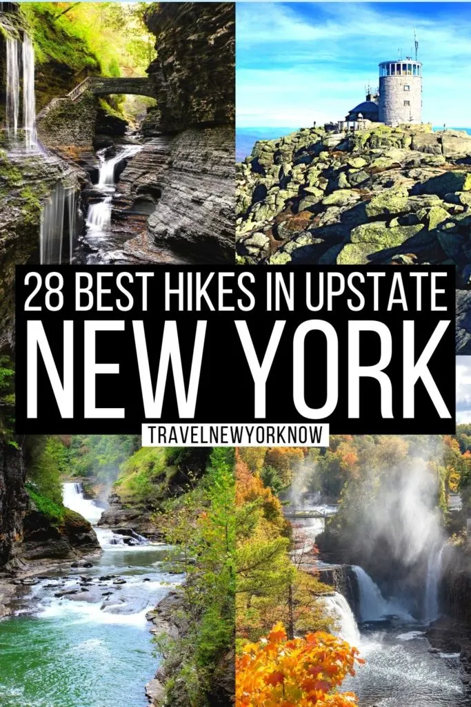
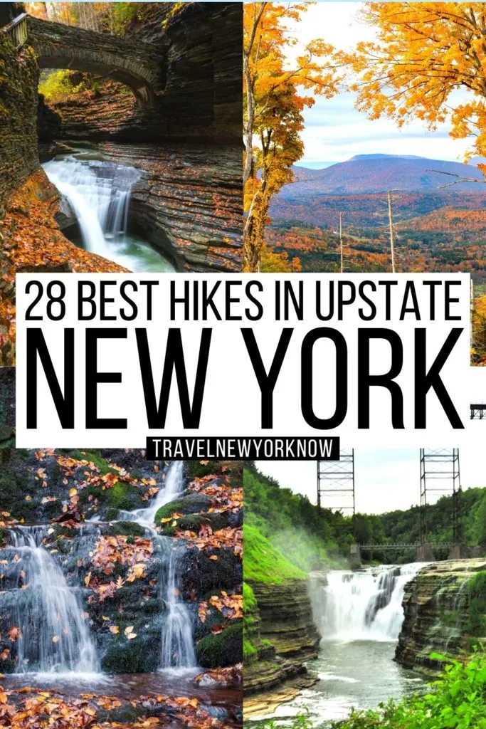
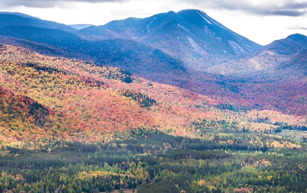
Looking to get away from the grit and grime of the city? If so then check out this next-level magical list of the best hikes in upstate New York.
Trust me on this people, New York is a veritable utopia for anyone and everyone who loves the great outdoors. And if anyone should know, it would be me.
After all, I’ve been living here for well over 30 years and have all the epic insider tips and tricks that you need to enjoy the very best hikes in upstate New York.
So, prepare to drive down idyllic country roads and hike through awe-inspiring mountain ranges as we uncover all of the very best hikes in upstate New York.
Because if you love things like awe-inspiring panoramic views, scrambling up sheer rock faces to enjoy beyond scenic overlooks, conquering seemingly neverending summits, exploring picturesque gorges, and standing beneath powerful waterfalls, then is the post for you!
Therefore, grab a bowl of your favorite trail mix and get ready to discover some of the very best hiking trails in upstate NY with me right now!
This post may contain affiliate links. Please see my disclosure for more information. As an Amazon Associate, I earn a small commission from qualifying purchases.
Table of Contents
Best Hikes in Upstate New York – Easy Hiking Trails in Upstate NY
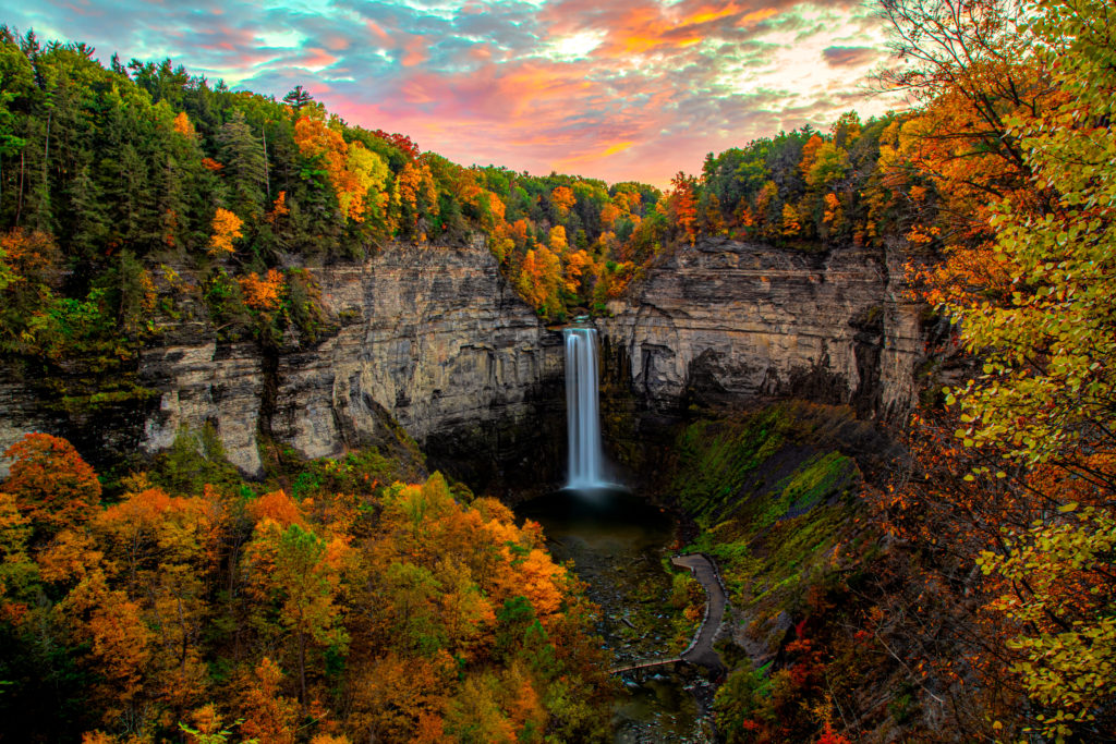
1. Taughannock Falls

Not gonna lie, I adore all of the best hiking trails in upstate New York that:
- Result in killer views like this one right here
- Don’t leave me not-so-low-key coughing up a lung by the end of the hike
And the Gorge Trail through Taughannock Falls State Parks is one of the best hikes in upstate New York that ticks both of those boxes.
So yeah, just think of this as a totally chill, 1-mile stroll through the woods -since it’s a flat trail that is well-marked – that terminates at the base of the park’s astounding, Taughannock Falls.
Yup, it’s a stunning, 215-foot tall waterfall that is actually taller than Niagara Falls. Yup, insert gasps of shock and awe here.
There are also beautiful, 400-foot tall cliffs surrounding the waterfall on either side, you know, just in case the falls weren’t picturesque enough on their own.
However, because this one of the many easy hiking trails in upstate NY, it gets hella crowded on the reg. So, before sure to visit early on a weekday morning to avoid the hordes of tourists.
Pro Tip: The falls are at their most impressive in the spring, right after the snow melts. Also, while you’re here, you can always do the South Rim Trail (around 1 mile) and the North Trail (around 1.5 miles) which leads you to the Upper Falls, aka Hidden Falls.
Location: Ithaca
Distance: 2.0 miles
Difficulty: Easy
Route: Out and Back
Elevation Gain: 183 feet
2. Gorge Trail at Watkins Glen State Park
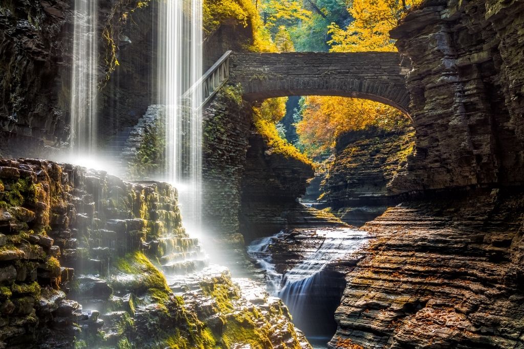

If you’ve hiked in New York even once, then you probably know all about the Gorge Trail at Watkins Glen.
After all, it’s easily one of the best hikes in upstate New York that takes you past 19 different waterfalls and makes you feel as though you’re extra on the set of a Lord of the Rings film.
And although the views from the main road near the entrance of the park are pretty dang sweet, I highly recommend that you along the picturesque Gorge Trail, which will eventually meet up with the Indian Loop.
It’s also not a difficult hike since it’s on a well-maintained stone path that takes you through the center of the gorge. However, you will encounter a grand total of 800 different steps along the way, which may be a concern for anyone with mobility issues.
In total, the hike will take around an hour and a half to complete, and easily connects with other hikes in the area like the South Rim Trail, the Indian Trail, and the Punch Bowl Trail.
Also, be sure to wear good hiking shoes and bring plenty of water/snacks, unless you want to buy some there. And while there isn’t a designated entrance fee, you will have to pay $8 to park in the designated lot and get access to the pool here.
Pro Tip: This is one of the best hikes in upstate New York that is basically a stone path with lots of stone steps. However, because there are waterfalls basically everywhere you look, the steps can get quite wet. Therefore, be sure to wear good hiking shoes with decent treads on them so you don’t slip.
And since you’re in the area anyway, you can take a 7-minute drive down the road to Shequaga Falls and see that too!
Location: Watkins Glen (Finger Lakes)
Distance: 2.4 miles
Difficulty: Easy
Route: Loop
Elevation Gain : 682 feet
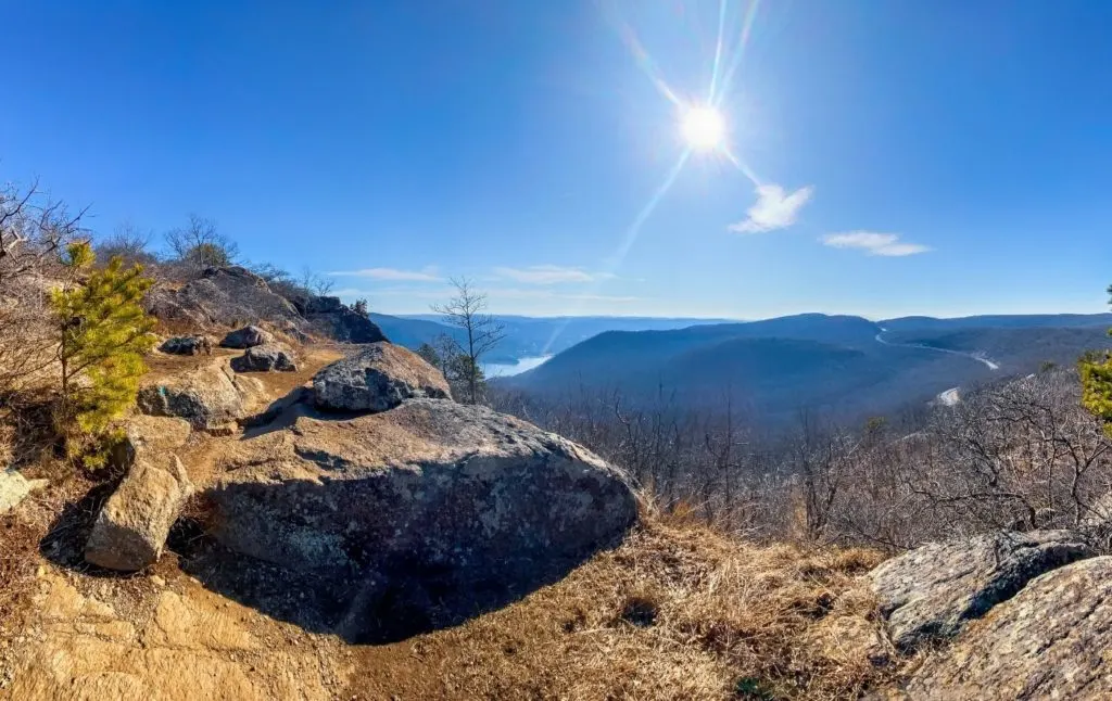
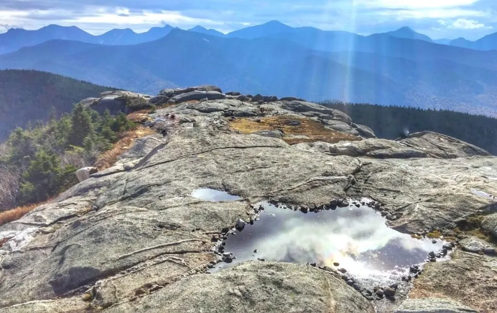
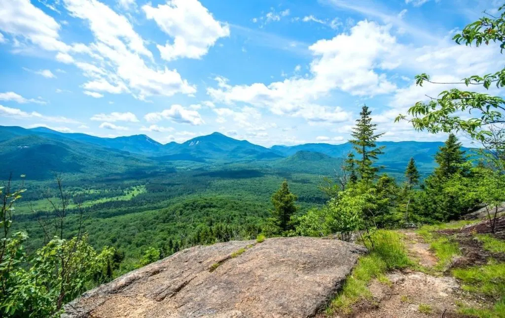
3. Cobble Lookout

This hike is a double threat since it’s one of the best hikes in upstate New York that also doubles as one of the top easy hiking trails in upstate NY too!
And if you decide to embark on this hike of awesome, you’ll be rewarded (handsomely) with sweeping views of the Adirondacks. You’ll also love that this hike isn’t quite as well known as some of the others on this list.
Therefore, you’ll probably have this place all to yourself and can actually enjoy the serenity of the natural wilderness that surrounds you – as opposed to doing a selfie-stick battle with 10,000 of your closest hiking neighbors.
It’s also relatively flat, super shady, and rewards you stellar views about 30-minutes in.
So, if you want to try one of the best hikes in upstate New York for yourself, just head to the Whiteface Mountain Highway near Lake Placid, Once there, turn left onto Gillespie Drive Junction and then continue on Gillespie Drive.
Continue down the road and the parking lot will be on your right. Before you go though, just keep an eye on the weather since this trail doesn’t get a lot of sun and can get REALLY muddy after a recent rainstorm. Afterward, head back to your room at one of the best all-inclusive resorts in New York.
Location: Adirondacks (just outside Lake Placid
Distance: 2.4 miles
Difficulty: Easy
Route: Out and Back
Elevation Gain: 242 feet
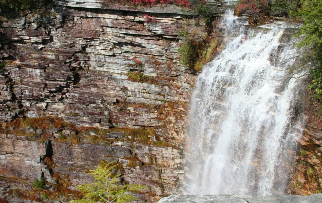
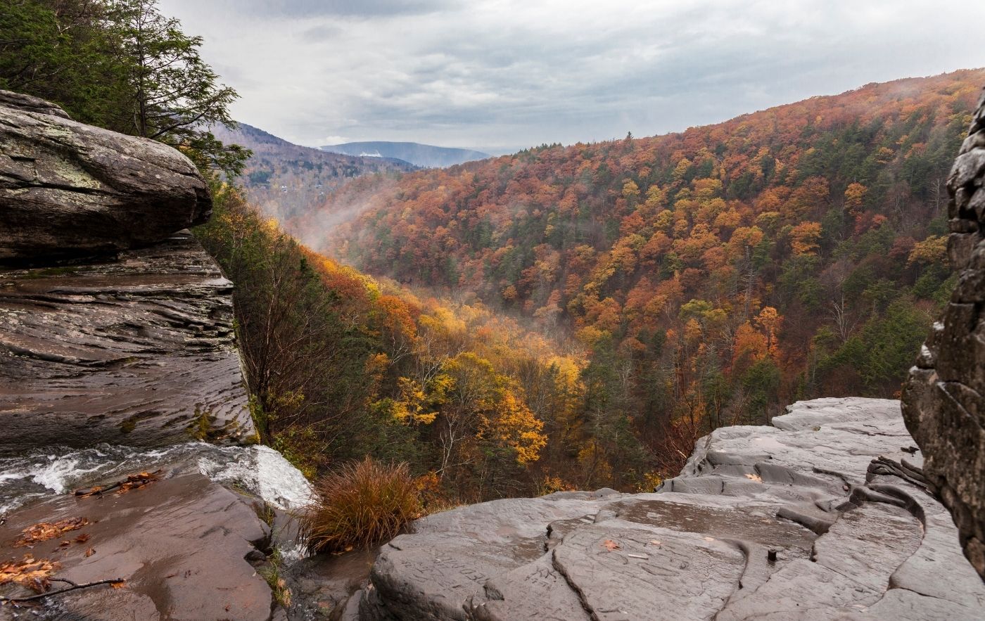
4. Kaaterskill Falls
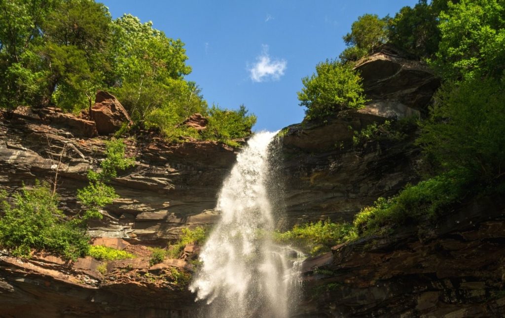

As the name might suggest, you’re doing this hiking trail in upstate New York for the supremely awesome views of Kaaterskill Falls.
However, just in case you’re not quite in the know, this iconic waterfall is actually a series of two cascading waterfalls that stand at 260 feet tall – the upper of which drops 175 feet while the lower waterfall cascades a mere 85 feet.
In fact, this waterfall is so stunning that it was actually referenced in Washington Irving’s immortal tale, “Rip Van Winkle”. So yeah, if that doesn’t get you to check out one of the best hiking trails in upstate New York, I dunno what will.
Especially since this is one of those easy hiking trails in upstate NY that is pretty dang short and that sits along a well-marked trail that brings your right to a viewing platform that overlooks the waterfalls.
And like I mentioned earlier, try and visit in the spring, right after the snow melts, since this waterfall can shrivel up during the heat of the summer.
FYI, you will also want to start at the top and then work your way down since the route is just generally safer.
Pro Tip: Park n the largest lot which is near Haines Falls, just near the end of Laurel House Road off of North Lake Road. And afterward, visit nearby Bastion Falls from Route 23A. Also, visit early on a weekday morning to avoid the crowds.
Location: Catskills
Distance: 2.0 miles
Difficulty: Easy
Route: Out and Back
Elevation Gain: 396 feet
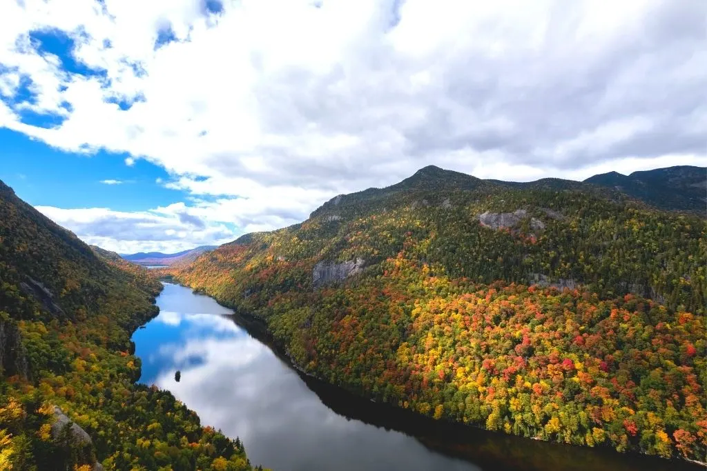
5. Ausable Chasm

This is one of the best hikes in upstate New York that is perfect if you’re part of a family with small children.
Because this privately owned trail is exceptionally well-maintained and starts off with a stellar view of Rainbow Falls from the exterior of the park.
Continue to the entrance and choose to hike on one of several different trails that will take you either through the back of the chasm or into the park itself.
Just be aware that because this is a privately owned park, you’ll have to pay $17.95 for an adult ticket and $9.95 for a children’s ticket (aged 5 to 12) to get into the park itself.
But once you fork over the cold, hard cash, you can walk along a vertical walled canyon, enjoy the views, and stand in awe of rock that dates back almost 500 million years.
Pro Tip: Make a day of it and do a supremely tame white water rafting sesh through the Gorge. This also makes a great day trip from Lake Placid and is best enjoyed in the spring when the water flow is at its most impressive.
Location: Adirondacks (near Keeseville)
Distance: 1.9 miles but 5 miles of trails in total.
Difficulty: Easy
Route: Varies
Elevation Gain: 328 feet
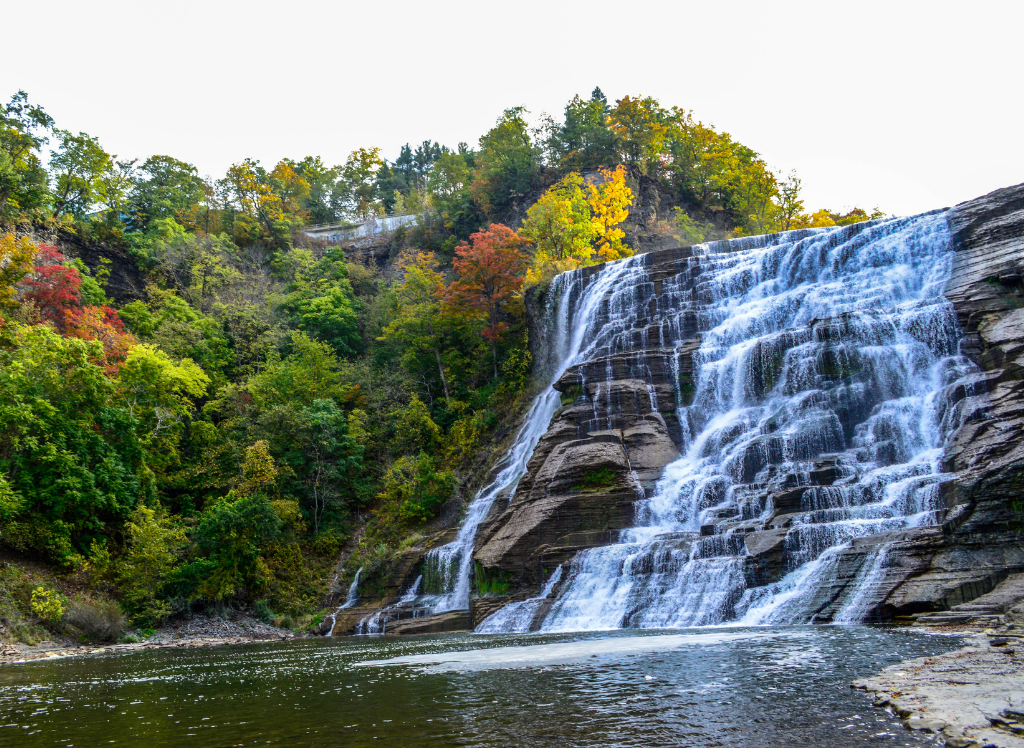
6. Buttermilk Falls

I know TLC infamously said, “don’t go chasing waterfalls…” but that’s kind of hard to do with impressive waterfalls like Buttermilk Falls near epic cities like Ithaca.
Which is why you should 100% hike the Gorge/Rim Trail to Buttermilk Falls.
After all, it’s located inside the impressive, 911-acre Buttermilk Falls State Park and is an easy, loop hike along the Gorge and Rim trail that starts with a gorgeous view of Buttermilk Falls – a waterfall that stands at an awesome, 165 feet tall and drops into picturesque Cayuga Lake below.
I also adore that this is one of the best hikes in upstate New York that is super accessible since the trail starts at the foot of the waterfall, right near the main entrance to the park.
So, if you’ve basically come here just to see this waterfall, then you can 100% skip this hike.
Otherwise, expect a super straightforward, easy hike that might get a little tricky in spots since there are some steep sets of stairs that you need to climb.
Thankfully though, you’ll see some quaint little waterfalls along the way that will make all the effort worth it. And when you’re done, do the full loop and take the Rim Trail back so that you can see something a little different.
Pro Tip: You will have to pay an $8 vehicle fee to get into the park.
Location: Ithaca
Distance: 1.6 miles (for the Gorge and Rim Trail to the waterfall)
Difficulty: Easy – it’s pretty easy but just be aware that there’s a steep/strenuous 1/2 mile section of the trail.
Route: Loop
Elevation Gain: 55 feet
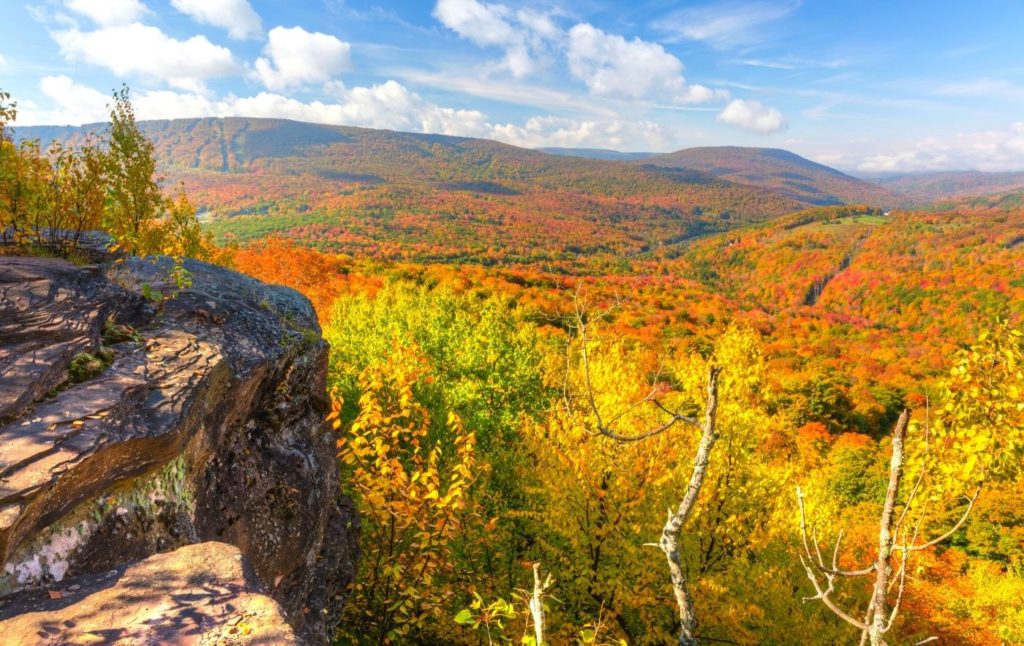
7. Overlook Mountain

Located in the ever immortal Woodstock, NY, this is one of the best hikes in upstate New York that can be found in the Catskills and that takes you up a gravel road that is flanked by not-so-aesthetically pleasing powerlines.
However, once you hit the two-mile point, you’ll uncover some awesome ruins that are from a long-forgotten, abandoned hotel. There will also be a fire tower here that you should definitely climb to the top of if you’re not too afraid of heights.
Because once at the top, you can admire get the not-so-distant Hudson River and the Ashokan Reservoir.
And when you’re done? Well, just sit back, relax, and marvel at the sweeping panoramas of the Catskills.
Pro Tip: Keep your eyes peeled for a plane crash along the way. You’ll also want to get here early on the weekend since the lot can only hold about 30 cars and gets filled up quite quickly.
Location: Catskills (Woodstock)
Distance: 4.6 miles
Difficulty: Easy
Route: Out and Back
Elevation Gain: 1,397 feet
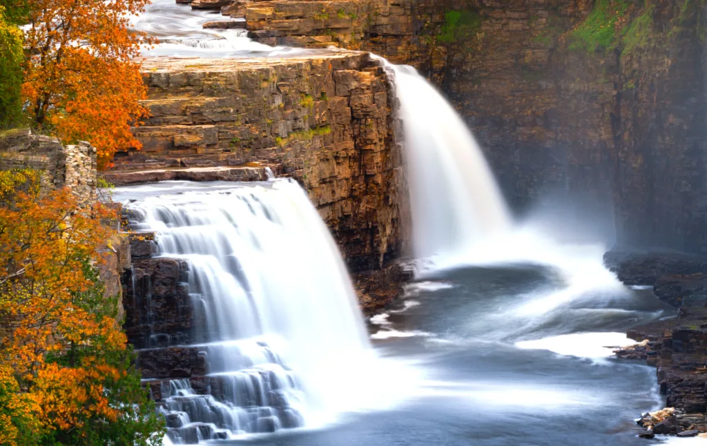
8. High Falls Gorge

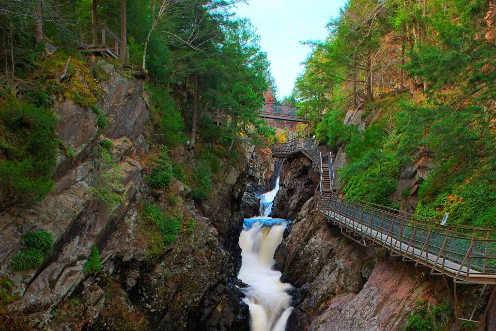
This is one of those easy hiking trails in upstate NY that is SO easy that even your granny could do it…in her sleep.
So, yeah, just think of this as one of the best hikes in upstate New York that is perfect for the whole family since this one-mile-long trail is made up of a series of elevated walkways that take you through the 22-acre, High Falls Gorge Park.
Along the way, you’ll be treated to sweet views of High Falls Gorge, where mighty AuSable River hits the canyon and creates a series of lovely waterfalls (High Falls waterfall is the real highlight but there are three others here too) that will probably take you around 45-minutes to enjoy.
Also, because this is another one of those “privately owned parks”, you can expect to pay $13.10 for adults and $10.10 for children (4-12).
However, this trail does have the added benefit of nifty, glass-bottom platforms that give you a great bird’s eye view of the gorge below.
There’s also a wealth of signage that gives you a full, uber-detailed history of the area. Something that is only appealing if you’re a total science nerd like me.
Location: Adirondacks (Wilmington)
Distance: 1.0 miles
Difficulty: Easy
Route: Out and Back
Elevation Gain: 167 feet
9. Vroman’s Nose Loop Trail
This low-key hike in central New York is tucked away inside the Roman Nose Unique Area and can be accessed from the trailhead at the parking lot on West Middleburgh Road.
Once on the trail though, it’s a pretty easy climb and you should 100% stop at the top for some gorgeous photos ops or for a nice picnic. In fact, you’ll hit the summit about half-way through the hike and can enjoy stellar views at the top since it’s relatively flat.
Then, when you’re heading back down, be extra careful since some sections do get steep and you can easily slip on some of the rocks or tree roots along one of the best hikes in upstate New York.
Finally, before you leave, be sure to stop at Under the Nose cafe for some delicious desserts and some all around great food too.
Pro Tip: If you can, do this loop hike in a counter-clockwise direction since the elevation gains will be a bit more gradual. You can also check out nearby Howe Caverns while you’re here.
Location: Middleburgh
Distance: 1.5 miles
Difficulty: Easy
Route: Loop
Elevation Gain: 485 feet
Best Hikes in Upstate New York – Moderate Hiking Trails in Upstate NY
10. Labyrinth Trail

Don’t let the short distance of this hike lull you into a false sense of security because a proverbial “walk through the park” it is not.
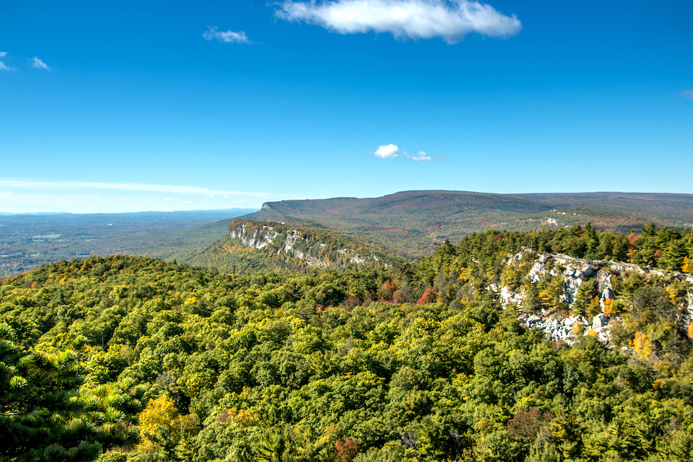
That’s due in part to the fact that this is one of the best hikes in upstate New York that can be found near the Mohonk Preserve, a natural area just outside of New Paltz that is known for its epic rock climbing opportunities.
So, be prepared for a sometimes strenuous journey through the grounds of the Mohonk Mountain House (a swank AF local resort), up the Labyrinth rock scramble, and through the crevice that is known as the Lemon Squeeze.
Once at the top of the Lemon Squeeze though, you’ll be treated to some of the area’s best views and can even climb up the awesome, Sky Top Tower just behind you.
it’s definitely not the easiest hike on this list but there are ample trail markers and there are some wooden ladders/stairways to help you traverse through the ginormous boulders that stand in your way to the top. For more info though, check out this guide here.
Pro Tip: If you’re here during Spring, call this number first – 845-256-2197 – to see if the trail is open. Also, be prepared to pay a hefty $29 per adult and $24 per kid (4-12 years old) to do this hike. Yes, you can save yourself some $$$ by doing a long, 8/9 mile hike to Labyrinth from Mohonk Preserve but it’s not really worth it.
Location: New Paltz
Distance: 1.0 miles
Difficulty: Moderate
Route: Out and Back
Elevation Gain: 291 feet
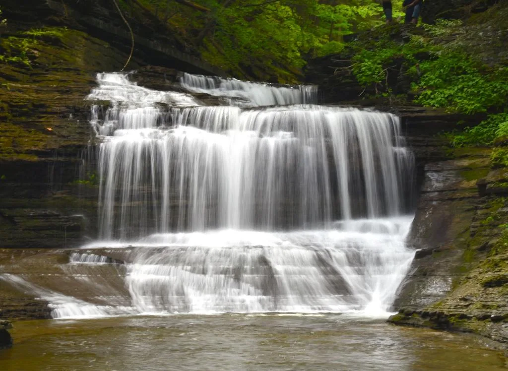
11. Rim and Gorge Trail, Robert H. Treman State Park

This is another one of the best hikes in upstate New York that can be found near good old, Ithaca, NY.
After all, this popular hike through the 1100 acre Robert H. Treman State Park is just fifteen minutes away from Ithaca and is home to a very impressive, 115-foot tall waterfall – Lucifer Falls – that sits at the Western Entrance of the park.
So, if you want to do this popular 4.3-mile loop trail for yourself, visit any time between April and November and start with the 2-mile Rim Trail.
It will take you on a winding hike through Enfield Glen to the base of Lucifer Falls. You’ll then continue upwards for an even more impressive view of the waterfall from the top.
Because the trail only runs in one direction though, you’ll then have to descend via the Gorge Trail. But honestly, the views on the way down are just as impressive so you’ll enjoy this hike too.
You’ll also pass by a grand total of 12 different waterfalls along the way, which is something that I for one think is pretty dang awesome.
Just do yourself a solid and bring all the essentials (i.e. bring water, snacks, and good hiking shoes) since this is a fairly long hike (it’ll take around 2.5 hours to complete) that will take you from the bottom of the gorge, up a set of natural stone steps, and onto the top of the rim.
And yes, you will have to pay $8 for a day-use pass.
Also, this isn’t a super difficult hiking trail in upstate New York but it gets a moderate ranking because there are several sets of stone steps that result in a 500+ foot elevation increase that can be pretty intense.
Pro Tip: Don’t forget to stop at the Lucifer Falls Overlook for a great view of Enfield Creek falling into the gorge below. d.
Location: Ithaca
Distance: 4.3 miles
Difficulty: Moderate
Route: Loop
Elevation Gain: 826 feet
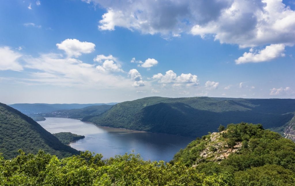
12. Anthony’s Nose
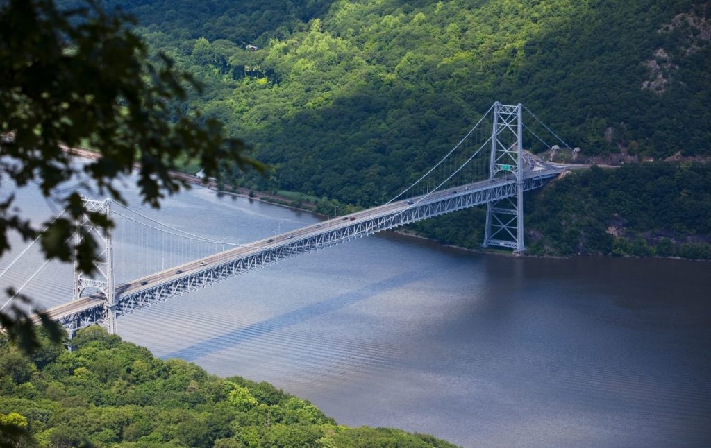
Located just across the Hudson River from Bear Mountain, Anthony’s Nose is one of the best hikes in upstate New York that is perfect for anyone looking to do a day trip from NYC.
Just hop on a Hudson line train from Grand Central and get off at Peekskill, right hear Cold Spring. The journey will take about an hour and you can then grab an Uber from there to Anthony’s Nose.
Now, once at the trail (just type “Anthony’s Nose” into your Google Maps and the trailhead should be off Route 9D just past the Bear Mountain Bridge) you’ll hike through Hudson Highlands State Park Preserve and can enjoy unique views of the Bear Mountain Bridge from the top.
Honestly, it’s not a supremely difficult hike but it does have a really steep half-mile-long section that features a 675-foot elevation gain.
But, if you’re in fairly decent shape, you should be able to tackle this hike since the remainder of the hike it’s fairly gentle.
Pro Tip: This is a REALLY popular hike and there is no designated parking lot. So, your best bet is to come early on a weekday and park your car on the shoulder of the road.
Location: Garrison, Hudson Valley near the Bear Mountain Bridge
Distance: 1.9 miles
Difficulity: Moderate
Route: Out and Back
Elevation Gain: 625 feet
13. Storm King Mountain Trail

Located right across the river from the aptly named Breakneck Ridge, Storm King Mountain Trail is one of the best hikes in upstate New York that will take you up through multiple ledges and across two different mountains (Butter Hill and Storm King), eventually culminating in some of the best views of the Hudson Valley around.
Thankfully, it’s a well-marked trail but if you can, try to do it in a clockwise direction to save yourself a whole lot of unnecessary pain.
Yeah, traversing the mountain in the other direction will force you to almost rock climb up some small sections which I for one am not all that comfortable with. Although, you could bring a walking stick with you to make things easier.
FYI, Storm King Mountain is also pretty famous so if you want the place all to yourself, try to visit early in the AM on a weekday.
Location: Cornwall, Hudson Valley
Distance: 4. 4 miles
Difficulty: Moderate
Route: Out and Back
Elevation Gain : 1,102 feet
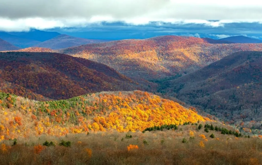
14. Cascade Mountain and Porter Mountain
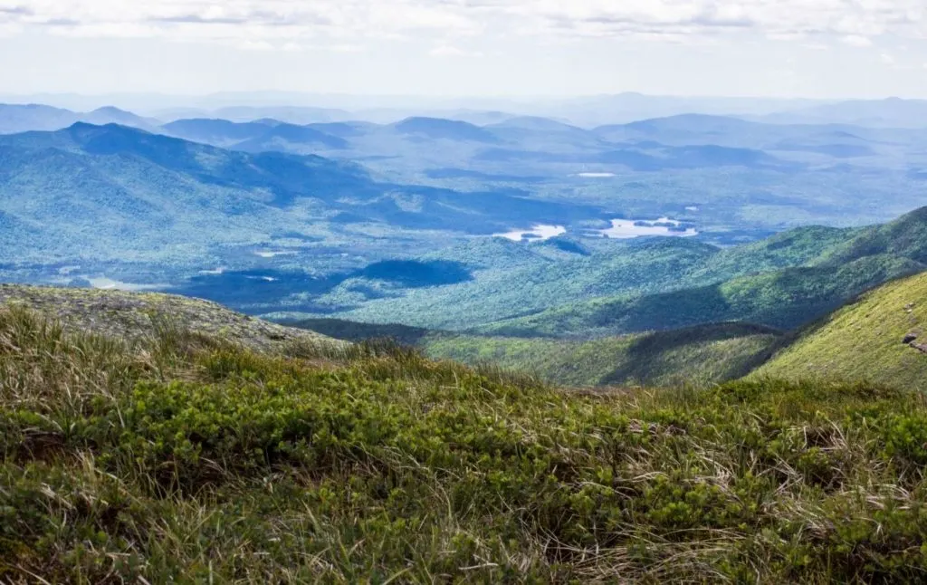
Home to 46 different peaks, it’s no small wonder that the Adirondacks region is known for having some of the best hikes in upstate New York.
And the trek up Cascade and Porter Mountain is one of the easiest around. So, to tackle this little gem fo a hike, just follow route 73 to Keene and to Cascade Mountain Trail.
Just be sure to visit sometime between May and October since this part of the state can get cold and is known for epic amounts of snow.
But if you’re here at the right time, you’ll find a mostly exposed path with some steep climbs and as well a few easy rock scrambles. You’ll also pass a river and waterfall along the way before enjoying stunning panoramas from the top.
And although it is one of the easiest hikes in the region, you will have to endure 1,940 feet of elevation gain – hence the outstanding views.
Also, at about two miles in, you’ll cross a junction with Porter Mountain. And since this hike only adds about 0.8 miles to your climb, I’d deffo summit Porter Mountain while you’re here.
Location: Keene, Adirondacks
Distance: 5.6 miles
Difficulty: Moderate
Route: Out and Back
Elevation Gain: 2,286 feet
15. Devil’s Hole Trail
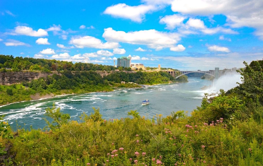

Get away from the strip malls and back into nature by doing one of the best hikes in upstate New York that is just a hoot and a holler down the road from Niagara Falls.
Located in – you guessed it – Devil’s Hole National Park, this quiet, lesser-known hiking trail in upstate New York is really only used by locals.
Therefore, it’s a great place to go if you want to escape the crowds of nearby Niagara Falls and savor the beauty of the wonderfully blue Niagara River.
So, start near the main parking area and the trail will immediately descend into the bottom of the 7-mile long, 300-foot deep, Niagara River Gorge.
You’ll then follow the trail for 2.5 miles along the banks of the river. Eventually, you’ll reach a junction with the Whirpool Rapids Trail that you can take to a scenic overlook of the whirlpool and the surrounding rapids.
Next, after taking in the iconic views, just go up the staircase and take the rim trail back to the parking lot.
And while the hike itself isn’t super challenging, the area can get quite slippery so be sure to stay well behind the guardrails.
Pro Tip: There are some picnic benches at the bottom, left-hand side of a set of stairs where you can sit and enjoy great views of our neighbors to the north, Canada!
Location: Niagara Falls
Distance: 5.0 miles
Difficulty: Moderate
Route: Loop
Elevation Gain: 994 feet
16. Poet’s Ledge

After a semi-treacherous walk from the parking area to the trailhead – along a major road with no shoulder – you’ll find Poet’s Ledge in Kaaterskill Wild Forest.
It’s one of the best hikes in upstate New York that is so amazing, that painter Sanford Robinson Gifford, a prominent member of the Hudson River School for painters, actually painted the view from this hike in 1861.
So, yeah, if good old Sanford hauled ass all the way to the top with painting supplies in tow, then you know this hike must be good.
And it is since the 1,661 foot gain in elevation leads to sweeping views of Palenville and the greater Hudson Valley from places like Maeli’s Lookout and Ella’s Ledge.
You’ll also pass several waterfalls along the way, as well as a seriously steep section that you’ll want to mentally prepare yourself for.
Pro Tip; Keep an eye out for bears since they live in the area and might want to say hello.
Location: Pallenville (Catskills)
Distance: 6.2 miles
Difficulty: Moderate
Route: Out and Back
Elevation Gain: 2,201 feet
17. Whiteface Mountain
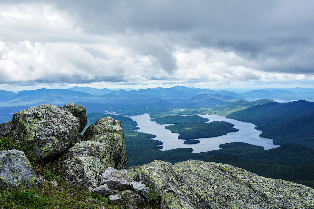

As the fifth tallest peak in the state of New York, Whiteface Mountain stands at an impressive 4,867 feet tall.
Therefore, although the hike up Whiteface isn’t technically challenging – there’s actually a road that basically leads up to the summit of the mountain – you will have to endure a grueling, 3,578-foot elevation gain to get to the top.
So, definitely come prepared and in pretty good shape to tackle one of the best hikes in upstate New York.
Other than that though, you’ll need to catch the trail at the Wilmington Trail trailhead near the Atmosphere Science Research Center parking lot.
The trail also isn’t too crowded since there’s a road that you can use to drive all the way to the top. And, well, most people opt for the path of least resistance.
Anyway, continue along the Wilmington Trailhead, eventually hitting Marble Mountain. Once here, get on the Esther Trail and then make your way to the summit of Whiteface.
And once at the top, admire the epic stone castle and the sweet views of Lake Placid, panoramas that can extend all the way out to Canada and Vermont on a nice clear day.
Pro Tip: Esther’s Trail isn’t officially maintained and can get muddy at times. Cascade and Porter Mountain are also both in the area and make for an accessible. 5.6-mile hike. You can climb both mountains in one day since it’s only another mile hike to the top of Porter Mountain once you’ve summited Cascade.
Location: Lake Placid (Adirondacks)
Distance: 10.1 miles
Difficulty: Moderate
Route: Out and Back
Elevation Gain: 3,618 feet
18. Gorge Trail in Letchworth State Park

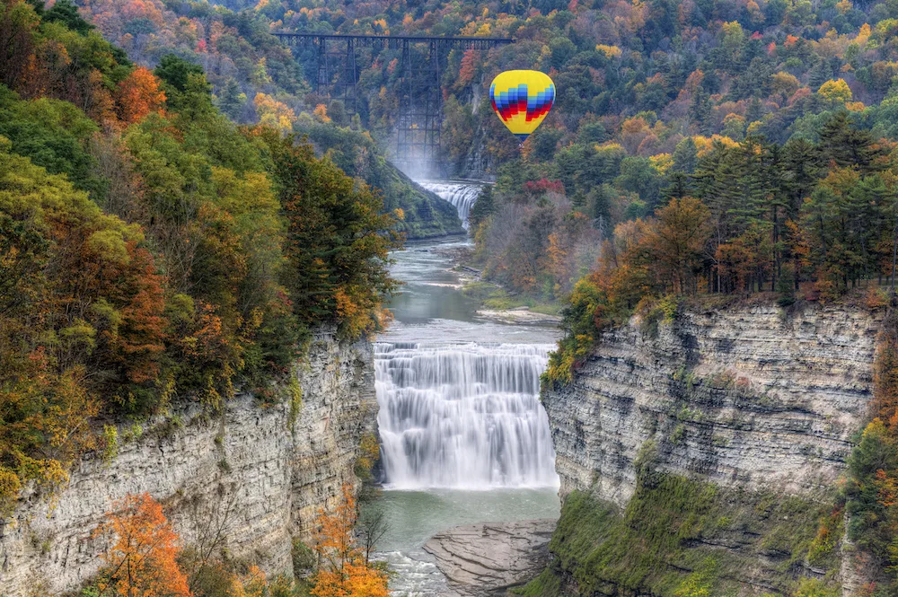
This is another one of the best hikes in upstate New York that isn’t super difficult but that is just rather long at a solid 14 miles.
Especially since this “trek” is more of a leisurely stroll through the woods that takes you along the Gorge Trail, as you experience some of the more than 66 miles of trails within Letchworth State Park.
However, it is easily the most popular trail in the park since it snakes along the east rim of Letchworth Gorge – fondly referred to as the Grand Canyon of the East – and features detours to various scenic overlooks of the park’s three major waterfalls – the appropriately named Upper, Middle, and Lower Falls of the Genesee River.
Ifyou have the time, be sure to stop at Inspiration Point, Wolf Creek, and The Tea Tables so that you can enjoy stellar views of the waterfalls and the canyon below.
Pro Tip: If this trail feels a bit long to you, you can always drive along some lengths since it really doesn’t stray too far away from the main road. Spring is also the best time to visit since the park’s waterfalls are at their most impressive and you will need to pay a day-use fee of $8.
Location: Castile (about an hour outside Buffalo)
Distance: 14 miles
Difficulty: Moderate
Route: Out and Back
Elevation Gain: 2,106 feet
19. Verkeerderkills Falls (and Sam’s Point)

Located in the always awesome Minnewaska State Park just outside of New Palts, this is another one of the best hikes in upstate New York that you’ll have to pay for.
But, that’s okay since it’s only $10 for a day pass and this is one of those top hiking trails in upstate New York that is well worth your time.
Now, once you’ve parked at the visitor’s center, prepare to be amazed by a 200-foot waterfall (aka Vekkeerderkills Falls), some neat ice caves, secret lakes, and a series of awe-inspiring viewpoints (Yes Sam’s Point, that means you).
The only teeny tiny problem you’ll have is choosing between the 5.6-mile trail or the longer, 8.6. mile that takes you through Sam’s Point Preserve and to the Rare Dwarf Pitch Pine Barren here.
Also, while you might initially assume that the Ice Cave Trail is open throughout the winter, it’s not. It’s also fairly intense and consists of a series of stairs, ladders, and wooden bridges that lead you to the largest exposed fault system in the entire country. Pretty cool, right?
Anyway, plan accordingly and visit in the spring so you can enjoy views of High Point Monument, the Hudson Valley, Roundout Valley, Verkeerder Kill Falls, the Ice Caves (they stay frozen all year long), and the Historic Berry Picker Shacks – vestiges of the past from when people use to harvest tons of blueberries here.
And, because this trail is popular with visitors, parking can be somewhat of an issue. Therefore, do try and visit early on a random weekday or morning, or SUPER early on the weekend.
Location: Minnewaska State Park Preserve (near New Paltz)
Distance: 6.2 miles
Difficulty: Moderate
Route: Out and Back
Elevation Gain: 994 feet
20. Jay Mountain

If you’re hiking in the Adirondacks they say hello to your new bestie – Jay Peak.
At 3,600 feet tall it’s easily one of the best hikes in upstate New York since it leads you along an open ridgeline and through a series of stunning forests.
Along the way, you’ll also discover a series of stunning viewpoints that offer great panoramas of Vermont, Lake Champlain, Whiteface Mountain, and the surrounding area.
However, before you reach the actual summit itself, you’ll hit a smaller summit at around 2.5 miles in. Once here, continue along the ridgeline for another 1.5 miles before getting to the summit of Jay Peak,
Location: Keene Valley, Adirondacks
Distance: 6.9 miles
Difficulty: Moderate
Route: Out and Back
Elevation Gain: 2,401 feet
21. Sleeping Beauty Mountain
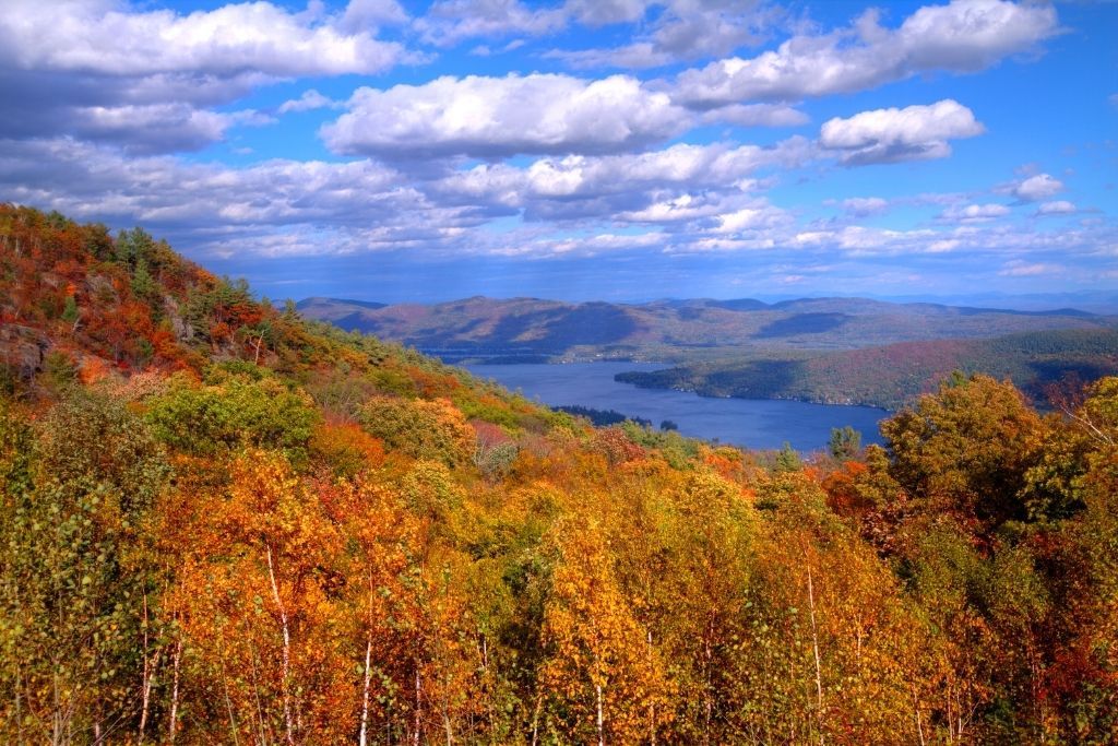

Hidden away along the eastern side of Lake George, the hike up Sleeping Beauty Mountain is perfect for anyone who wants a not-so-challenging trek that features stunning views of the Adirondacks.
So, if you think this might be one of the best hikes in upstate NY for you then just choose between the 6.4-mile loop trail at the Hog Town parking lot or the 4.8-mile loop from the Dacy Clearing parking lot.
Both routes are pretty rad and include several switchbacks that help keep the steepness of the trail somewhat manageable. It also doesn’t hurt that you’ll get to see beautiful forests, amazing lakes, and stellar mountains along the way.
Also, while the hike from Dacy Clearing may be shorter, it does mean that you’ll have to drive your vehicle over rough terrain that not every car can handle.
If you do make it to this lot though, it’s a 1.8-mile trek to a local lookout and then another 0.4 miles to the summit where you can admire Crane Mountain and Killington in the distance.
Pro Tip: While this can be an out and back hike, I’d do the loop and go down some switchbacks past Bumps Pond for a different view on the way back.
Location: Fort Anne (near Lake George)
Distance: Between 5 and 7 miles
Difficulty: Moderate
Route: Loop
Elevation Gain: 1,341 feet
22. Giant Ledge and Panther Mountain
Another one of the best hikes in upstate New York in the Catskills, the hike up to Giant Ledge and Panther Mountain covers a respectable 7.1 miles and will take you past stunning fields of wildflowersone – at least if you visit at the right time of year (aka spring or summer).
Also, this is one of the best hiking trails in upstate NY that is not a hidden gem. So yeah, you deffo won’t have the place all to yourself.
However, what this trail lacks in privacy it more than makes up for with five separate ledges that all form the entire Giant Ledge area.
And while the hike to Giant Ledge is only 3 or 4 miles round trip, it’s quite steep so get ready to work up a sweat.
Plus, once you hit Giant Ledge, it’s really only another mile until you summit Panther Mountain and can marvel at the views from there.
Pro Tip: There are tons of campsites in the area if you want to chillax and spend the night.
Location: Oliveira (Catskills)
Distance: 7.1 miles
Difficulty: Moderate
Route: Out and Back
Elevation Gain: 1,981 feet
23. Mount Van Hoevenberg Trail

Looking for another one of the best hikes in Upstate New York that also happens to be in the Adirondacks?
If so then mosey on over to Mount Van Hoevenberg and enjoy all the magic of the high peaks region during this glorious, 4.4 mile (round trip), out and back hike through New York’s famed high peaks region.
After all, this trek is easily accessible from one of two trailheads that will take you along the east or west trail. So, start your hike at either the Mt. Van Hoevenberg East Trail parking lot or the the South Meadows Camping Area (for the western section of the trail).
Then, once on the trail, just enjoy an awesome walk through the woods. As you start off, the terrain will be pretty flat and you’ll come across a lovely beaver pond after hiking for about an hour.
After this point, the hike gets a whole lot more intense when it comes to elevation gains, but its totally worth for the panoramas that you get from the top.
Location: North Elba (right near Lake Placid)
Distance: 4.4 miles
Difficulty: Moderate
Route: Out and Back
Elevation Gain: 892 feet
Best Hikes in Upstate New York – Difficult Hiking Trails in Upstate NY
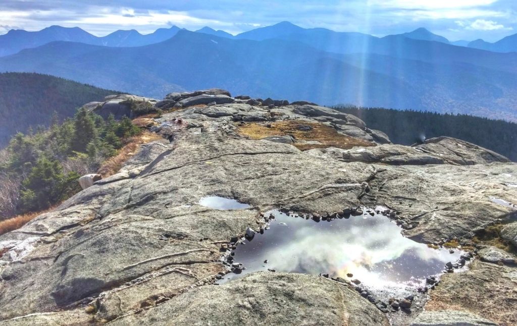
24. Mount Marcy

Not to be taken lightly, this staggering, 14-mile round trip hike up New York’s tallest peak (at 5,344 feet) includes more than 3,166 feet of elevation gain that serious climbers will love.
So, if you want to conquer New York’s tallest peak yourself, I’d park at the Adirondack Loj Parking Lot and then ascend the mountain via the Van Hoevenberg Trail.
It’s about 7.4 miles long and starts off pretty easy with a transition to a steep climb up varied terrain that has lovely views of nearby Mount Colden, Avalanche Mountain, and Wright Peak.
Once you hit an old dam, follow/cross Phelps Brook and continue on the herd path to the top of Indian Falls (there’s a great view of MacIntyre Range here).
After Indian Falls, continue up the timberline and expect the intensity to really pick up at around the 6.8-mile mark. Just be sure to save some energy for the top since the last mile is steep beyond belief (channel your inner Billy Goat).
And although there are three other trails that you can use to get to the top, the one I just described is the shortest and most popular Mount Marcy hike.
Pro Tip: This hike will take around 10 hours to complete and requires serious gear. You’ll also want to pay close attention to weather conditions since they can change rapidly at the top.
Location: Lake Placid (Adirondacks)
Distance: 14.8 miles
Difficulty: Hard
Route: Out and Back
Elevation Gain: 3,540 feet
25. Breakneck Ridge

Because this Hudson Valley area hike is so easily accessible from NYC, it’s easily one of the most popular hikes in New York.
It also doesn’t hurt that this trek is home to some of the best views in the entire Hudson Valley. And that makes sense since this hike sits smack dab in the middle of the quaint little towns of Beacon and Cold Spring.
However, Breakneck Ridge is tough (hence the name) and is known for steep, rocky terrain that makes you feel like you’re rock climbing more than hiking.
So, do expect to scramble up almost vertical rock faces. But, if you’re up for the challenge (it’s tough but definitely possible) then catch the trailhead right off of 9D, near a tunnel.
It’s basically just outside Cold Spring (2 miles or so) so you can easily take the train here from Grand Central here. Just hop on the Hudson Line and take it to Cold Spring.
In total, the trip will take about an hour and a half and you can call for an Uber once you arrive.
Pro Tip: Don’t forget to check out the fire tower at the top.
Location: Cold Spring (Hudson Valley)
Distance: Between 2.5 and 4 miles
Difficulty: Hard
Route: Loop
Elevation Gain: 754 feet
26. Wittenberg Mountain

The good news? This is one of the best hikes in upstate New York that gives you stellar views of the Catskills (from 3,780 feet in the air since that’s how tall the mountain is).
The bad news? This trek is tough with a capital “T” since you’ll face an elevation gain of 2,500 feet. But, with great challenges come great rewards since this is one of only 35 peaks in the region that soar to a height of more than 3,500 feet.
Just catch the trail at Woodland Valley Campgrounds and be prepared to go near vertical as much of the trail is rocky, super steep, and absurdly treacherous.
Insanity that is balanced out by great views of Ashokan Reservoir and some fun rock scrambles on the way to the top. Just do yourself a solid and pack a lunch so you can picnic at the top.
Pro Tip: If you’re up to it, add an extra mile to your hike and climb along a narrow ridgeline, through the Cornell Crack, to the top of Cornell Mountain.
Location: Phoenicia (near Kingston in the Catskills)
Distance: 8.5 miles
Difficulty: Hard
Route: Out and Back
Elevation Gain: 3,103 feet
27. Mount Colden

Channel your inner Bear Grylls and tackle one of the best hikes in upstate New York for total outdoor pros.
Just choose between one of three trails to the summit – the Lake Arnold trail (the easiest and the one I’d use), the Trap Dyke Trail, and the Mt. Colden Trail
Now, once you’re chosen your route to the top, your hard work will quickly be rewarded with sweeping views from scenic overlooks that start just a few miles in, where old Marcy Dam once stood and where you now see sweet mountain views.
As you continue, the trail will get perpetually steeper, eventually leading you to Avalanche Pass. Use the up/down ladders and walkways here
to traverse through the wealth of canyons and gorges that can be found in the area.
Plus, if you’re feeling extra energetic, hit up the “hitch-up-matildas”, or a series of walkways attached to the mountain and that will drop you right into the water of Lake Colden below.
And after a refreshing dip, just go back the way you came and conquer Mount Coulden for lovely views of the MacIntyre Range and Mt. Marcy.
Pro Tip: Popular trail best used between June and November. Dogs are allowed but must be kept on a leash at all times.
Location: Lake Placid (Adirondacks)
Distance: 12.8 miles
Difficulty: Really Hard
Route: Loop
Elevation Gain: 3,061 feet
28. Dix Mountain
And last, but certainly not least is one of the most challenging but best hikes in upstate New York. It’s a rugged, 13.2-mile trail (about 8 hours to complete) that is best used between May and November.
Before you start though, you’ll need to choose between one of two main starting points – the Round Pond entrance about 1 mile past the Chapel Pond parking area (you’ll see a DEC sign) and the Elk Lake entrance on Blue Ridge at the“Elk Lake Lodge” sign.
Personally, I’d go with the Trail at Round Pond just because the Elk Lake trail is usually closed. From here, it’s a moderate climb from Route 73 up to Round Pond.
After the pond, you’ll hit an intersection, after which the trail levels out until you reach the Bouquet River Lean-to (at 4.2 miles).
From here, the climb gets progressively steep and won’t level out until you reach the summit. Just be prepared to climb up wickedly steep terrain in exposed areas that cover large distances.
Also, be on the lookout (get it?) for exquisite panoramas of the Green Mountains of Vermont and the White Mountains of New Hampshire.
The tallest peak in the Dix Mountain Wilderness and the only one having a well designated and well-maintained trail leading to the summit, Dix is the sixth-largest mountain in the Adirondacks.
The Adirondacks’ solitary natural splendor may be appreciated in this section, which is far more distant than the Great or MacIntyre range.
It offers some of the nicest views in the Adirondacks because it is a largely bald summit. The whole Great Range is visible to the northwest, and the MacIntyre Range’s lower peaks are visible behind them.
Giant and Rocky Peak Ridge are to the NE, Elk Lake is to the SW, and Lake Champlain may be seen well to the east.
Apart from its isolation, Dix stands out for its many and intriguing ascent routes. There are up to five trailheads, and each one offers fantastic two-day walks.
Since the summit is relatively distant, not often frequented, and far from any trailhead, it should only be tackled as a day trek in good summer weather and with an early start.
Apart from that, there are many of locations to camp, and there are usually always unoccupied lean-tos nearby. In fact, my visit to this region was the first occasion I had ever discovered an unoccupied lean-to during the summer.
The two primary beginning locations are from the S from Elk Lake and from the N off Rt. 73.
Pro Tip: If you want to use the Elk Lake trail, you can use the Hunter Pass Trail (7.3-miles one-way) or take the Hunter Pass Trail to the Beckhorn Trail (6.6 miles one-way) since it’s not as steep and used by most hikers.
Location: Keene (Adirondacks)
Distance: 13.2 miles
Difficulty: Hard
Route: Out and Back
Elevation Gain: 3,471 feet
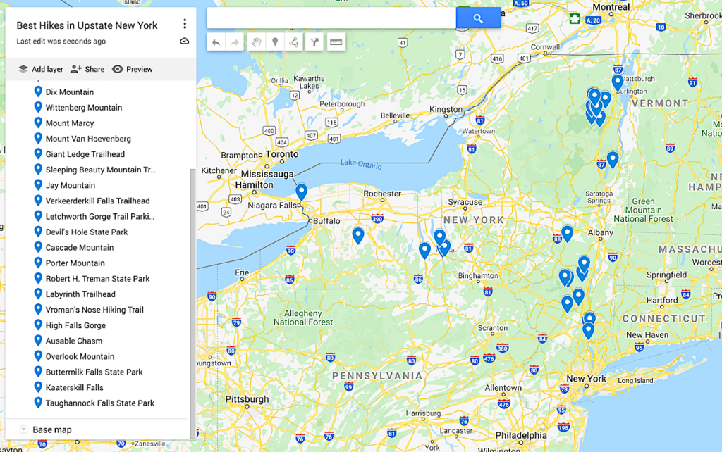
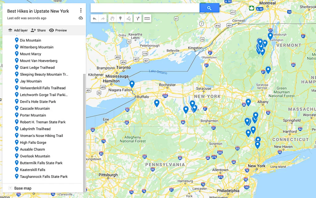
Map of the Best Hikes in Upstate New York
Additional New York Travel Resources You’ll Love
- Best things to do in Lake Placid
- Best Winter Hikes in New York
- The Ultimate New York Road Trip
- Best Yoga Retreats in New York
- Best hikes in New York
- Best Hikes in the Adirondacks
- Best Hikes in the Catskills
- Best Hikes in the Hudson Valley
- Best Hikes on Long Island
And there you have it! That concludes this wicked awesome guide to all of the best hikes in upstate New York!
Tell me, did all of your picks for the best hiking trails in upstate New York make the list? If not then let me know in the comments below.
And if you found this post useful, be sure to join our mailing list before pinning this post now so that you can read it again later!