Grab a giant handful or trail mix and don your raddest and baddest pair of hiking boots because we’re about to swan dive into this epic post about 22 of the best hikes near NYC.
Because, yes my friends, this is an expertly curated list of the best hiking trails near NYC – a series of treks that will help you make the most out of the beautiful summer and fall weather as you escape the confines of the city and get out into the wide open spaces of the Hudson Valley, the Catskills, New Jersey, and beyond.
And as an outdoor loving, 30+ year New York local, I’m just the person to show you the ropes (lame pun intended) as you go hiking near NYC and enjoy the incredible scenery that this part of the country has to offer.
So, if you’re ready, come with me and experience some of the best hikes near New York City that are easily accessible by public transportation and (usually) less than three hours away from the city.
This post may contain affiliate links. Please see my disclosure for more information. As an Amazon Associate, I earn a small commission from qualifying purchases.
Best Hikes Near NYC – Westchester/The Bronx
1. Old Croton Aqueduct Trail
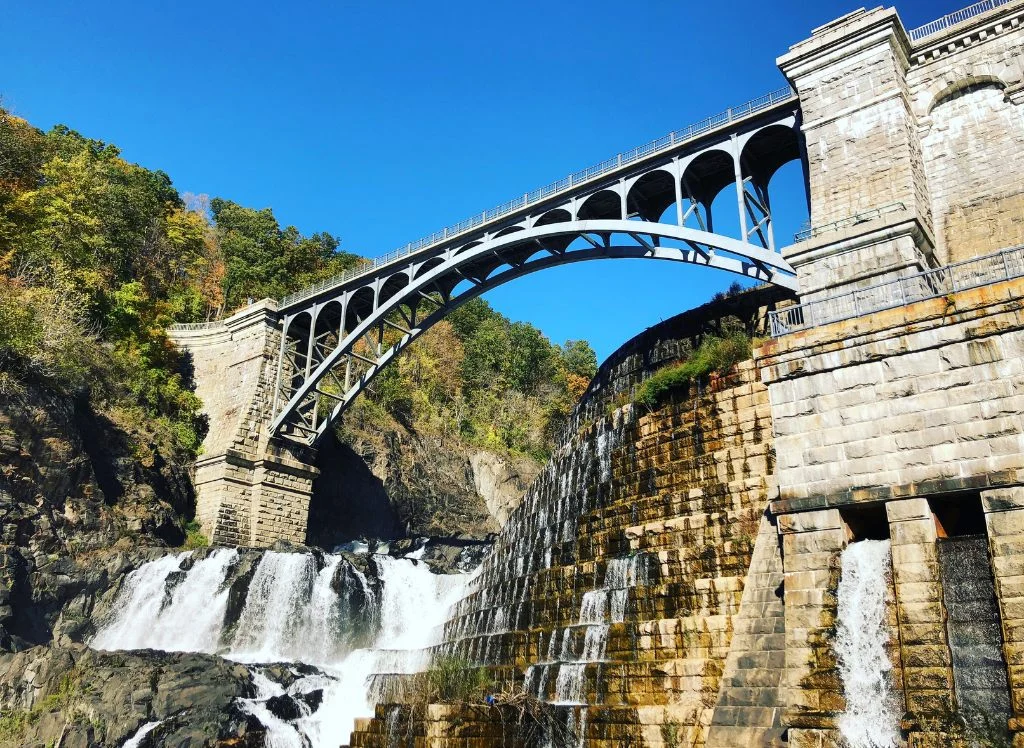
Rich in history and spanning a large portion of the Bronx and Westchester county, the Old Croton Aqueduct Trail was first completed in 1842 and is a well defined, easy-to-follow, multi-use path that walkers, hikers, joggers, and bikers can use to escape the chaos of the city.
In fact, this hike near New York City is so iconic that is is now on the National Register of Historic Places since it was initially designed to bring fresh drinking water into the city.
So, if you’d like to experience one of the best hikes near NYC for yourself, start at the New Croton Dam and pass along 21 ventilators that are now the remaining vestiges of the old aqueduct.
Continue for about three miles until you hit the town of Crotonville, followed by town of Ossining in another two miles. Feel free to get off whenever you like since there are many access points along the 26 miles of the trail that culminate at Van Cortlandt Park in the Bronx.
But, some major trail highlights include Sleepy Hollow (say hi to the Headless Horseman for me), the Tappan Zee Bridge, Lyndhurst (an awesome Gothic Revival Mansion), the Keeper’s House, and more.
Pro Tip: You can easily take a Hudson Line train here from Grand Central and get off at any station between Greystone and Ossining. Also be careful since many sections of the trail cross along busy streets where cars will NOT stop for pedestrians.
Location: Bronx/Yonkers/Yorktown
Distance: 26.5 miles (from Van Cortlandt Park/Hancock Avenue in Yonkers to Croton Dam Road at the New Croton Dam in Yorktown)
Difficulty: Easy:
Route: Out and Back
Elevation Gain: 300 feet.
Distance from NYC: 15 miles or about a 40 minute drive if you start in Van Cortlandt Park in the Bronx.
2. John Muir Nature Trail
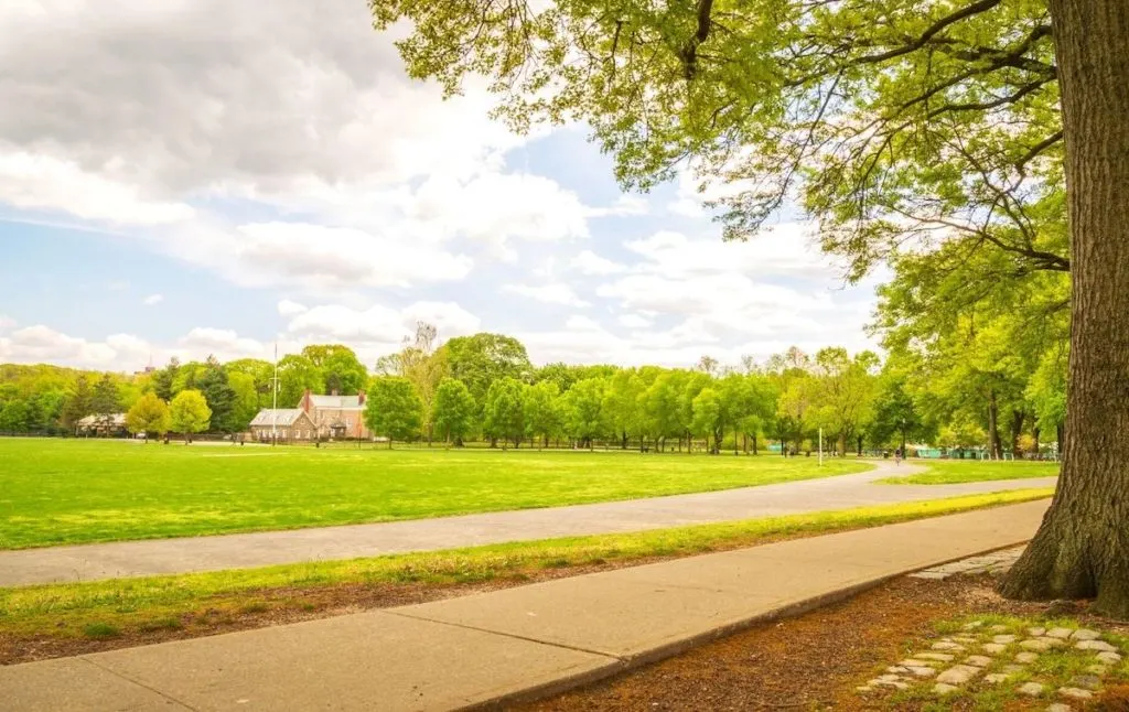
Take the 4 train from Grand Central all the way to Moshulu Parkway station and experience one of the best hikes near NYC. Because it’s here that you’ll find the Bronx’s immortal, 1,146-acre, Van Cortlandt Park.
And luckily for you, this trail sits about five minutes from the subway and is home to the easy, well-paved, John Muir Nature Trail.
Just enter at either Broadway and Mosholu Avenue or Van Cortlandt Park East and Oneida Avenue and make your way ( from east to west) through three ecological unique forests.
Eventually, you’ll pass by the Sweetgum, red oak, and tulip trees of the Northeast Forest before hitting a marsh filled with frogs and the Croton Woods. It’s here that you’ll also find the Old Croton Aqueduct and the hickory trees of the Northwest Forest.
Location: Bronx, NY
Distance: 3.9 miles
Difficulty: Easy
Route: Out and Back
Elevation Gain: 301 feet
Distance from NYC: About a 45-minute subway ride away from Midtown.
Best Hikes Near NYC – The Hudson Valley
3. Anthony’s Nose
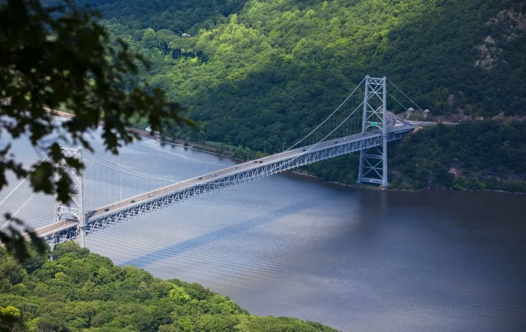
Easily one of the most well-known, top hikes near NYC, Anthony’s Nose is a moderately difficult climb that lies just across the river from Bear Mountain State Park, right near Cold Spring.
So, if you’re looking to do a bit of hiking near NYC then this epic climb will be a real treat. After all, it features awe-inspiring views of both the Hudson Valley Highlands and the Bear Mountain Bridge.
Plus, it has the added benefit of being an ideal day trip from NYC since you can get here in about an hour if you take a Hudson line train from Grand Central to Peekskill station.
Once at the station, catch at Uber and take it to the trailhead on Route 9D. Just put “Anthony’s Nose” into Google and it should come up for you.
Now, is this the most challenging hike on this list of the best hiking trails near NYC? No, but it does feature an intense half-mile section with a significant amount of elevation gain that you should be prepared for.
Other than that, it’s a pretty chill climb to the top. Just get here early (or go on a quiet weekday morning) to avoid the masses of day-trippers from NYC.
Pro Tip: There’s no parking so anyone driving here will have to park on the side of the road. You can also hike the Appalachian Trail while you’re here since the two run into one another.
Location: Garrison, Hudson Valley near the Bear Mountain Bridge
Distance: 1.9 miles
Difficulty: Moderate
Route: Out and Back
Elevation Gain: 675 feet
Distance from NYC: 52 miles or an hour and fifteen minute drive.
4. Breakneck Ridge
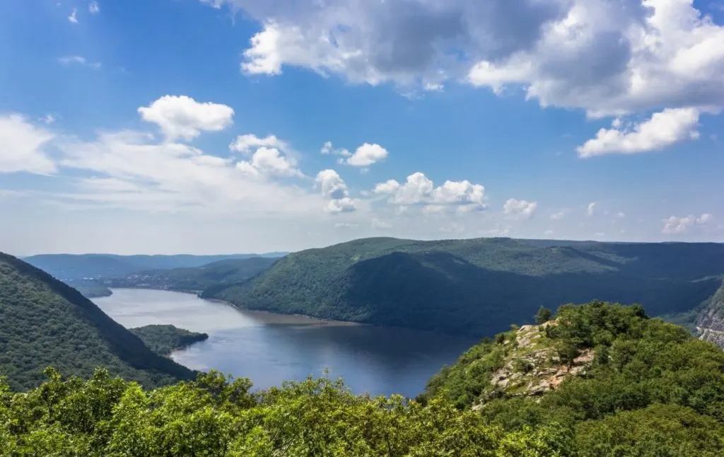
This is one of the best hikes near NYC that is intense with a capital, “I”. But, that makes sense since the name of this climb is pretty ominous and leads you to believe that this trek won’t be just another easy stroll through the woods.
However, if you’re a seasoned hiker who is up for a little challenge, then head to Grand Central and take a Hudson Line train to Cold Spring station. The trip should take around an hour and a half and you can then take an Uber to the trailhead from here.
Then, start your hike at the southern Breakneck Trailhead and move in a counterclockwise direction. Trust me, this will help make one of the best hiking trails near NYC infinitely easier while still allowing you to enjoy lovely aerial views of the Newburgh=Beacon Bridge, Bannerman’s Castle, and Storm King Mountain.
There’s also a ton of rocky terrain along this trek. So, be sure to wear the right shoes since many sections will make you feel like you’re rock climbing, not hiking.
Therefore, get ready for some almost vertical rock scrambles before taking in some of the area’s most impressive views of the Hudson Valley.
Pro Tip: If you want, you can use a bypass trail to steer clear of the more intense sections of this hike. Also, be sure to ascend to the top of the fire tower at the summit.
Location: Cold Spring
Distance: Between 2.5 and 4 miles
Difficulty: Difficult
Route: Loop
Elevation Gain: 1,250 feet
Distance from NYC: 63 miles or about an hour and a half drive.
5. Lake Skenonto Loop
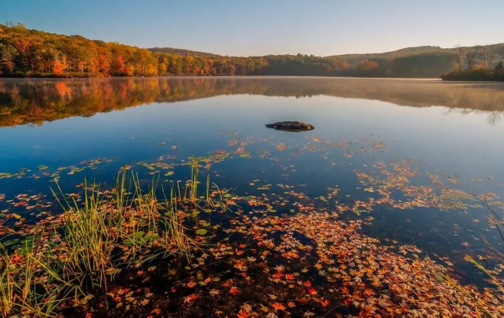
Located in the always awesome Harriman State Park, this is one of the best hikes near NYC that is easily accessible by train.
So, head to Penn Station and take a New Jersey Transit train to Tuxedo station. Once here, you can easily walk about a half mile to the trailhead (off Grove Street) and then enjoy a pretty chill stroll around one of the best lakes in New York.
Yes, there are a few rocky bits and uphill sections. So, do come prepared with hiking boots and a map. But, overall, this is a fairly tame hike that most people should be able to do, no problem.
Also, as you enter the park and begin hiking near NYC, you’ll follow the rad blazes onto Ramapo Dunderburg trail, eventually stopping for lunch near Parker Cabin Mountain (right before the Triangle Trail) since there are some stellar overlooks here.
You’ll then continue along the blue Victory Trail and make your way to Lake Skenonto, where you can continue around the lake and along one of the best hiking trails in New York.
Pro Tip: This trail is best used between April and October. Also, do NOT swim in the lake or you will get a ticket.
Location: Tuxedo Park, NY
Distance: 8.1 miles
Difficulty: Moderate
Route: Loop
Elevation Gain: 1,505 feet
Distance from NYC: 45 miles or a one hour and 15 minute drive.
6. Pine Meadow Trail
Another one of the best hiking trails near NYC that lies within Harriman State Park, this hike is easily accessible via train (take a Port Jervis line train from Penn station to Sloatsburg station) and is a great option if you’re looking for an easier hike that still offers stellar views.
So, you’ll start this hike at the Reeves Meadow Visitors and hop on the Pine Meadow Trail from there. Continue along Stony Brook and Pine Meadow Brook and then either go clockwise or counterclockwise around the lake.
Once you near the end of the loop, turn right onto Pine Meadow Lake Woods Road to reconnect with the Raccoon Brook Hills Trail and Pine Meadow Trail.
If you want, you can then use the Kakiat Trail and take that to the Stony Brook Trail if you want to avoid a bit of monotony, on one of the top hikes near NYC when it comes to scenery.
Location: Sloatsburg, NY
Distance: 10.0 miles
Difficulty: Moderate
Route: Loop
Elevation Gain: 1,171 feet
Distance from NYC: 50 miles or an hour and 15 minute drive from NYC.
7. Arden Point and Glenclyffe
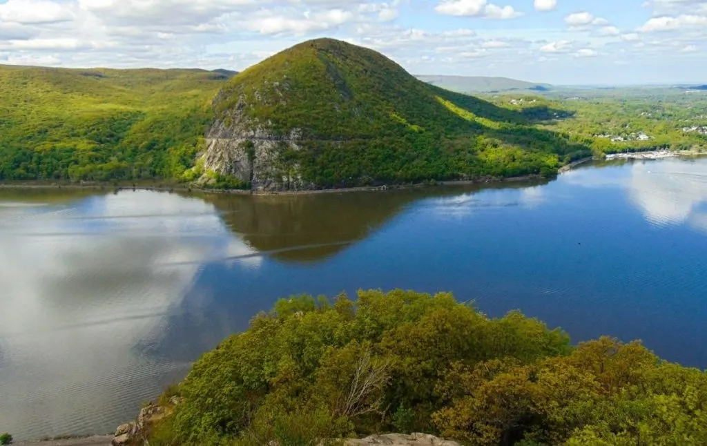
Hidden away in Hudson Highlands State Park, this is one of the more popular trails on this list of the best hikes near NYC that lakes you on an easy loop through one of the Hudson Valley’s most popular parks.
So, to get the most out of hiking near NYC, start at the Arden Point entrance and access the trailhead from here, You’ll discover a blue blazed woods road that will take you across a small bridge over a stream.
After about a half mile, turn right and go over the bridge and follow the blue blazes of the trail to Arden Point. Eventually, bear right onto a red-blazed trail that will take you past a stone wall and to the edge of the water, with a beautiful view of West Point and the Hudson River off in the distance.
Take in the stellar views here before hopping back on the red-blazed trail and taking it to a scenic overlook above the Hudson River. Stay on this trail until you hit a bridge that you’ll cross, eventually turning right on the white blazes of the Marcia’s Mile trail.
Head into the woods and at the junction, turn right and go up a set of stone steps to the red-blazed, Glenclyffe Loop. You’ll see a gazebo straight ahead and can stop here to take in some stunning panoramas.
Next, cross a rocky outcrop and then continue along the trail into a ravine. Eventually, the hike will follow along Beverly Dock Road and pass two ponds before bringing you to a sign for the Garrison Institute.
Once here, turn left into the paved entrance road and follow the white blazes of Marcia’s Mile as you pass a pond on your right. Eventually, turn right onto the road that you started from. You’ll see a bridge here but instead of crossing it, go straight ahead and onto the blue-blazed woods road as you make your way back to where you began.
Pro Tip: This is another one of the best hiking trails near New York City that is easily accessible by train. Just take a Hudson line train from Grand Central to Garrison station.
Location: Garrison
Distance: 3. 8 miles
Difficulty: Easy
Route: Loop
Elevation Gain: 278 feet
Distance from NYC: 62 miles or an hour and a half by car.
8. Gertrude’s Nose
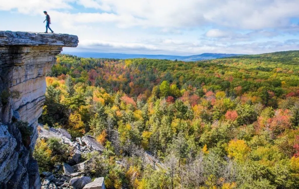
Easily one of the best hikes in the Hudson Valley, Gertrude’s Nose sits inside Minnewaska State Park Preserve and begins at the Millbrook Mountain Trail.
You’ll know you’re here when you see vibrant, aqua blazes marking the trail near Trapps Road Bridge. Then, when you get to the bridge, continue up a rock path and walk by rock faces until you hit Skytop Tower.
Don’t worry, you’ll see a sign telling you to stop and enjoy the view before continuing for another 3.5 miles until you hit an intersection that will lead you to the summit of Millbrook Mountain.
From here, continue along Gertrude’s Nose Trail (keep an eye out for red blazes) and slowly head downhill, beneath some power lines, until you can walk no further and have arrived at Gertrude’s Nose.
Next, retrace your steps to the junction with Millbrook Carrigaeway and follow the Millbrook Trail to the Coxing Trail and then just go back the way you came. Also, per usual with all of the best hikes near NYC in this park, you will need to pay a $15.00 day use fee.
Location: High Falls, NY
Distance: 6.7 miles
Difficulty: Moderate
Route: Loop
Elevation Gain: 1,141 feet
Distance from NYC: 87 miles or a 2 hour and 10 minute drive.
9. Storm King Mountain Trail
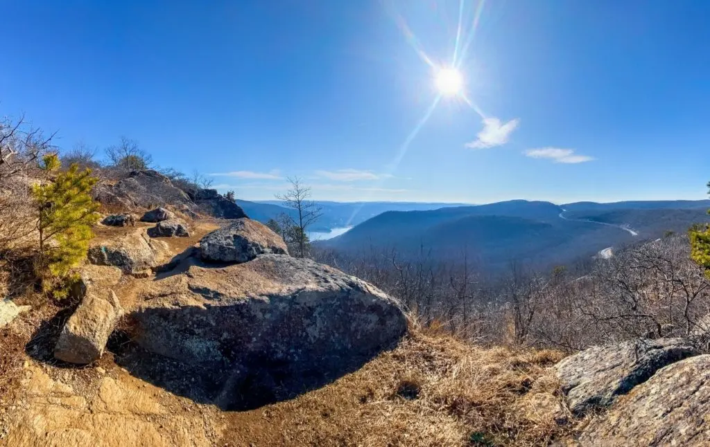
Because of the awesome outdoor sculptures/art center here, this is easily one of the most famous hikes near NYC on this list. It also offers eager hikers sweeping views of Breakneck Ridge and is not to be missed if you plan on hiking near New York City.
So, if you’re up for a mildly difficult, art-filled challenge then hop on the trailhead by way of a small side street on Bayview Avenue. Then, once you’ve found one of the top hikes near New York City, you’ll pass by several ledges before summiting Butler Hill and Storm King Mountain.
Therefore, while this hike can feel like a bit of a slog at times, it’s still pretty easy to follow and is nothing too challenging, particularly if you travel in a counterclockwise direction.
Pro Tip: Get here early to avoid the hordes of visitors. .
Location: Cornwall
Distance: 4. 4 miles
Difficulty: Moderate
Route: Loop
Elevation Gain: 1,200 feet
Distance from NYC: 63 miles or about an hour and a half drive.
10. Mount Beacon Fire Tower
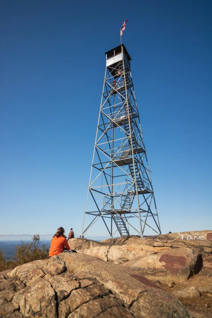
Ready to experience one of the best hikes near NYC that will take you to the top of a glorious fire tower? If so then get ready for a fun/challenging hike to the summit of Mount Beacon, aka the tallest peak in the Hudson Highlands.
Just catch a Hudson line train to Beacon station and walk to the trailhead in Mount Beacon Park. Once here, you’ll make your way along various switchbacks as you pass by decrepit chairlifts from the long-forgotten Dutchess Ski Area here.
Eventually, you’ll hit the top and can enjoy stunning views, in addition to a rogue powerhouse that was formerly used to power an incline railway on the mountain.
But, to get to the top of this legendary fire tower, you’ll need to hop on the red trail and continue for another mile until you connect with a white trail that will take you to the summit on the southern side of the mountain.
It’s here that you’ll find this fire tower, where you can climb to the top and admire nearby Skycap Tower and Breakneck Ridge.
Pro Tip: You can also do a scenic detour to the Daughters of the Revolutionary War Memorial before getting a frozen treat at Zora Dora’s ice cream shop.
Location: Beacon, NY
Distance: 4.0 miles
Difficulty: Moderate
Route: Out and Back
Elevation Gain: 1,410 feet
Distance from NYC: 67 miles or an hour and forty minutes.
11. Bull Hill Loop
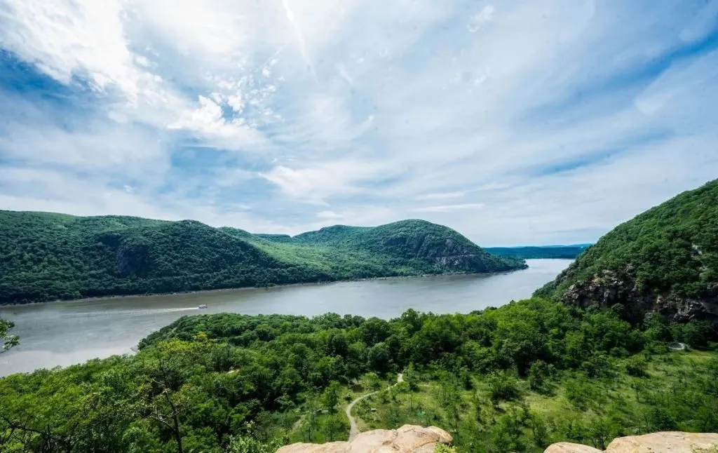
This semi-challenging hike near Cold Spring will take you into the heart of Hudson Highlands State Park Preserve and past a lovely local waterfall.
It’s also one of the best hikes near NYC that is easily accessible since you can get here by way of a Hudson line train from Grand Central to Cold Spring station.
Then, once you get to the preserve, start at the Little Stony Point parking area and go right onto the Washburn Trail. You’ll continue down an old road and hit some nice overlooks just after the trail intersects with the Undercliff Trail.
You’ll then hit a rocky section just before the summit where you can enjoy even more sweeping panoramas, only this time of the Hudson River,
Continue to the summit and then descend via the Washburn Trail. It will take you down an old road that terminates at the junction with the Nelsonville Trail and the North trail.
Go left onto the Brook Trail and then make another left onto the Cornish Trail at the next junction. Once on this trail, you’ll pass the remnants of an old Cornish Farm and can then follow the trail left to where you started your hike on one of the top hiking trails near NYC.
Location: Cold Spring
Distance: 5.4 miles
Difficulty: Moderate
Route: Loop
Elevation Gain: 1391 feet
Distance from NYC: 62 miles or just under a two hour drive.
12. Lake Minnewaska Loop Trail
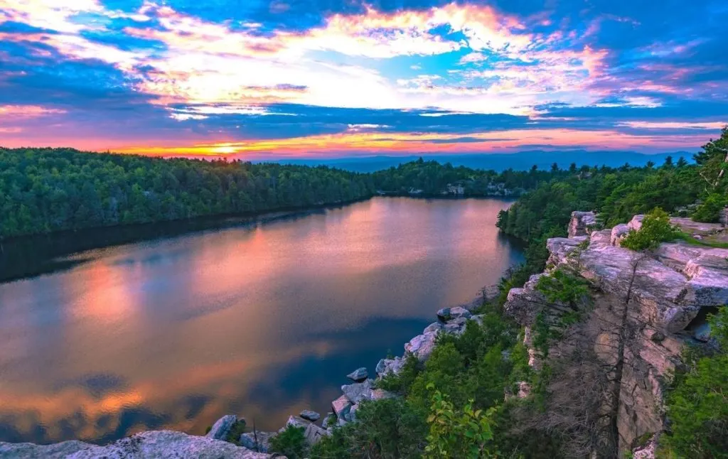
Well my friends, this is another one of the best hikes near NYC that is located in Minnewaska State Park Preserve. So, sadly, you will have to pay a $15 day-use fee to access this trail.
However, once you’re here, it’s an easy and super scenic hike along the perimeter of Lake Minnewaska. It’s also a popular trail, that is best used between April and October, so try to arrive early to avoid the crowds.
Also, pay attention to where you’re going since there are tons of forks that could easily lead you away from the main trail. However, it’s a well-paved trail that will take you over picturesque wooden bridges and to some of the best views inside this amazing preserve.
Pro Tip: If you plan on visiting Minnewaska State Park Preserve, you should definitely get the Empire Card so that you can use many of the best hiking trails near NYC for free.
Location: Kerhonkson, NY
Distance: 1.9 miles
Difficulty: Easy
Route: Loop
Elevation Gain: 259 feet
Distance from NYC: 96 miles or a little over a two hour drive.
13. Suffern-Bear Mountain Trail
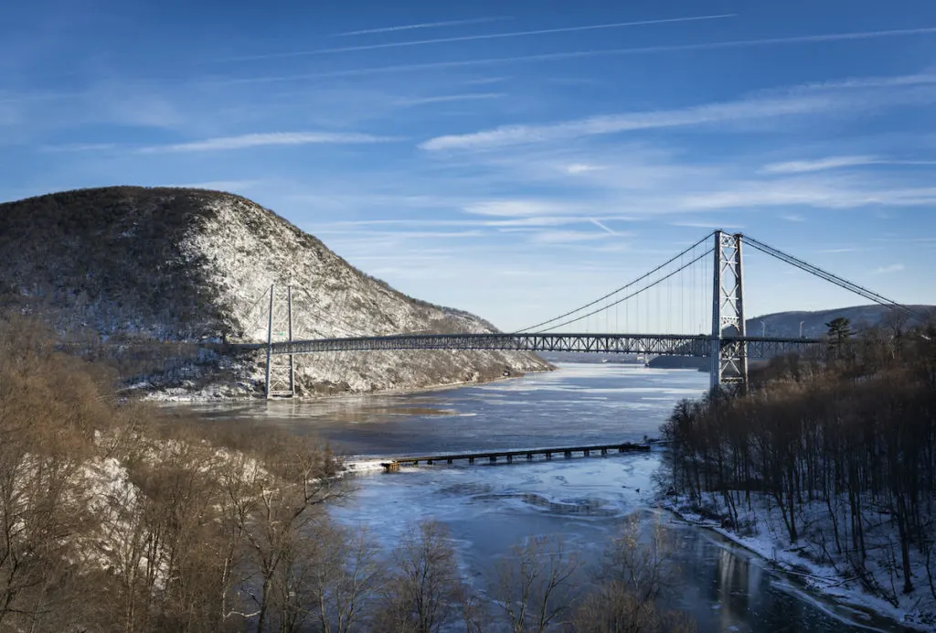
I’m gonna give you fair warning because this is one of the best hikes near NYC that is most assuredly NOT for the faint of heart. So, come prepared (with plenty of water and good hiking shoes) to do an intense, 20+ mile climb through Harriman State Park (near Suffern) and into Bear Mountain State Park.
You’ll also need to be extra careful when trying to find the trailhead since it’s exceptionally well-hidden. So, just park at a nearby restaurant and venture towards the bridge to get on the trail.
Once here, you’ll follow the yellow blazes and experience a whole lot of steep ups and downs that will bring you near cliff edges and to a particularly intense section about headway through at the Pyngyp.
If you can, do this trail over the course of a weekend and spend the night at one of the lean-tos at Stone Memorial or Big Hill. You’ll then finish up at Bear Mountain and can grab a quick beer before heading back to the city by train. .
Pro Tip: If you don’t want to hike the entire thing in a day (I don’t blame you), you can always do it in five to fifteen mile sections that are pretty dang stunning. You can also take the bus here from NYC (Shoreline Bus from Port Authority to Suffern) and then walk to the Metro-North station at Manitou (from Bear Mountain) to return to Grand Central at the end of the trail.
Location: Suffern, NY
Distance: 23. 2 miles
Difficulty: Difficult
Route: Out and Back
Elevation Gain: 5,196 feet
Distance from NYC: 41 miles or about an hour drive away.
14. Blue Mountain Summit Loop
Located in the northwest part of Westchester County, the Blue Mountain Reservation has some of the best hikes in NYC. One of the best trails here is the Blue Mountain Summit Loop. The 6 miles hike will take you through some of the most scenic parts of the park.
While the trek is one of the most popular ones in the area, you can get some solitude if you plan your trip well. Ideally, April to October are the best times of the year to hit this trail. The climate is great, the leaves are green and the outdoors is the perfect place to be.
One of the great things about this trail is the chance to see a lot of wildlife. From deer to birds and squirrels, you are always bound to see something. Plus, there are loads of spots to stop at on the way. Streams and brooks allow you a spot to dip your toes into the cool water on a hot day.
Did I mention that the trail is pet friendly? Yes! You can take your dog on your hike too!
Location: Westchester County
Distance: 6miles
Difficulty: Moderate
Route: Loop
Elevation Gain: 777 feet
Distance From NYC: 48 miles
15. Appalachian Trail
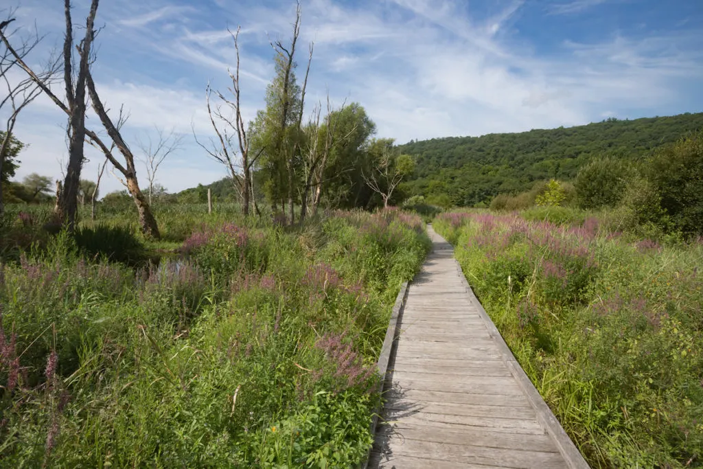
Possibly one of the most famous hikes in the country, the Appalachian Trail is an epic, 2,160 mile hike that spans the length the east coast of the USA, from Springer Mountain in Georgia to Mount Katahdin in Maine.
So, although you can’t hike this entire trail from NYC, a 90 mile section of this trek does run through New York (and New Jersey too) and comes within a mere 30 miles of the city – hence the reason why this trail makes it on this list of the best hikes near NYC.
Therefore, if you choose to tackle the aforementioned Anthony’s Nose hike, you’ll actually be on the Appalachian Trail.
However, if you want to do this entire 90 mile stretch, you’ll need to begin in Port Jervis, go through Bear Mountain, conquer the Lemon Squeezer, pass by the Trail Station, and finish at the Great Swamp – which would lead through-hikers to Connecticut.
Location: Hudson Valley but the Bear Mountain section ism fave.
Distance: 90 miles but you can do sections as day hikes.
Difficulty Level: Easy/Moderate
Route: Out and Back
Elevation Gain: 400 feet
Distance from NYC: 30 miles or about a 45-minute drive.
16. Camp Smith Trail
It is no secret that the Appalachian trail gets crowded. It is after all one of the best hikes near NYC and it is remarkably popular. Bear mountain is another place that follows suit. Most people tend to look for some peace and quiet when they get out of the city which these trails may not always provide. Which is why I always suggest heading out on the Camp Smith trail.
This trail leads right upto the Anthony’s Nose Overlook. Now, I know that there are other trails that do the same but this one is a quieter one and has less footfalls. Plus it is well marked.
Don’t expect a simple stroll. There are places that will challenge you. All in all, we are talking about a moderate to difficult hike that should take you about 3 hours give or take. In fact, some people have described it as the most rugged trail in Westchester County.
I find that this one is one of the best trails for solo hiking. They also allow dogs on the trail which means that your furry friends can have a great workout too! Oh and this is an off the leash trail unlike many of the other trails in the area which is another big draw!
Like many of the different hikes in and around the Hudson valley, this trek too gives you some incredible views. One thing that I can guarantee though. If you head out on the Camp Smith Trail, you are more than likely to find a spot where you can sit quietly and just connect with nature. Plus, it isn’t too far from the other popular trails in the area which makes it very accessible.
Location: Hudson Valley
Distance: 3.4 miles
Difficulty: Moderate to strenuous.
Route: Out and back.
Elevation Gain: 1759 feet
Distance From NYC: 50 miles
Best Hikes Near NYC – The Catskills
17. Giant Ledge and Panther Mountain
Easily one of the most famous hikes near New York City, this Catskills area trek is a popular day hike for locals and visitors alike.
So, come early and make your way along a trail featuring five different ledges that collectively form the one and only. Giant Ledge.
And although the milage on this hike (to Giant Ledge) isn’t too terrible, there’s a lot of elevation gain. Therefore, the trail is pretty steep and you should defy wear good hiking shoes and bring lots of water.
If you want, you can also make a night of it at one of the campsites here or continue for another mile to the top of Panther Mountain. This way, you can get the most out of your visit and savor some of the best panoramas in the region.
Location: Big Indian
Distance: 6.3 miles
Difficulty: Moderate
Route: Out and Back
Elevation Gain: 1,981 feet
Distance from NYC: 140 miles or just under a three hour drive.
18. Verkeerderkill Falls Trail and Sam’s Point
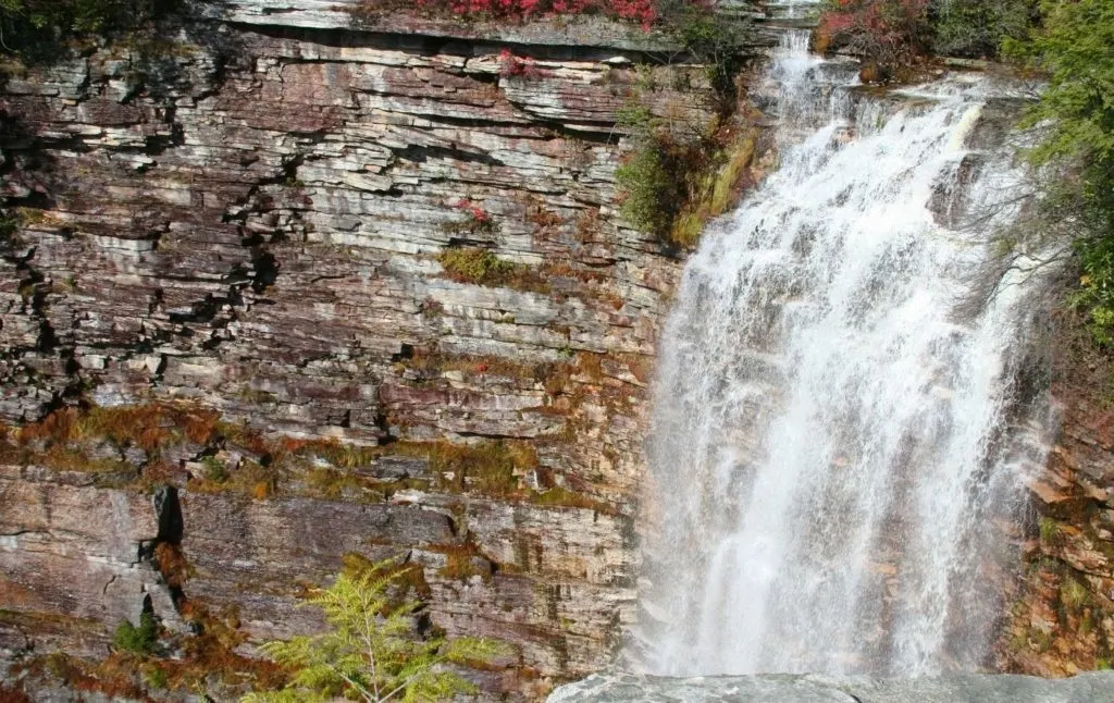
Tucked away inside of Minnewaska State Park (so yes, you will have to pay a $15 day-use fee), this is one of the best hikes near NYC where you can park your car at the visitor’s center and then do either a 5.6-mile hike to the falls or a 8.6 mile to the falls and Sam’s Point.
Regardless of the route you choose, the hike will be a challenge and require you to traverse a variety of stairs, ladders, iron rungs, and wooden bridges that will lead you to the largest exposed fault system in the country.
If you have the energy for it though. definitely opt for the longer trek since Sam’s Point features some legendary views, in addition to some stellar panoramas of the legendary, 200-foot tell, Verkeerderkills Falls.
Plus, if you stop by during the summer, you can also explore some nearby ice caves that remain frozen all year long (just use the Ice cave Trail) before checking out High Point Monument and some historic Berry Picker Shacks too.
Pro Tip: Parking here is annoying so get here super early.
Location: New Paltz
Distance: Between 5.6 and 8.6 miles
Difficulty: Moderate
Route: Out and Back
Elevation Gain: 994 feet
Distance from NYC: 96 miles or about an hour and a half drive.
19. Bonticou Crag Trail
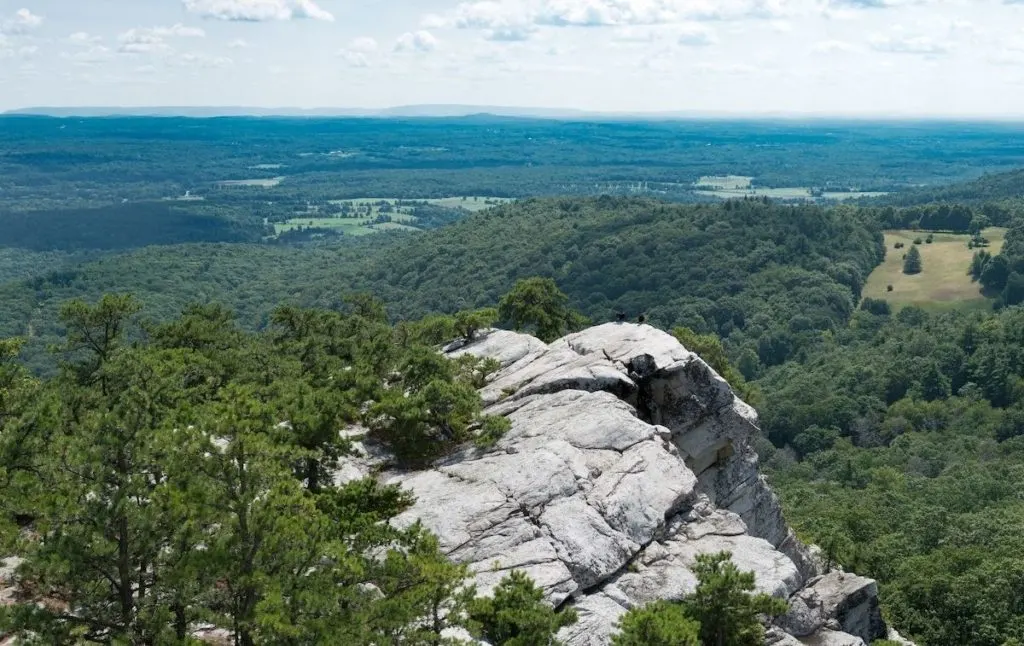
This is one of the best hikes near NYC that can be found in one of my all-time favorite parks in the state – Mohonk Preserve. So, to get here from NYC, take a Hudson line train from Grand Central to Poughkeepsie station and then catch an Uber from here.
Just be aware that the drive from Poughkeepsie to the park is a bit long. Like, 30-minutes long. So, if you can, have a friend pick you up and take you there.
Otherwise, head to the Mohonk Mountain House parking lot and pay the $15.00 day-use fee at the guard shack. After parking, hop on the Crag Trail, follow the red blazes past a meadow, and eventually cross Spring Farm Road into the woods.
You’ll then come to a somewhat confusing intersection and will want to make a soft left turn onto Bonticou Road. You’ll then hit a rock scramble and will follow the red blazes of the Bonticou Ascent Path downhill. Continue straight and prepare for a bit of bolder hopping along the trail up to the summit.
Admire the sweet, sweet views and then take the yellow trail down (on the right) and into a pine forest. You’ll then turn right onto the blue-blazed Northeast Trail, eventually turning left onto the red blazed Clearwater Road.
From here, take a slight detour and follow the Table Rocks Trail to Table Rocks. Be sure to take a break here and soak in the views, being careful not to fall into any chasms.
Next, go back the way you came and follow the blue blazes onto Farm Road. Then, just follow the road past a pavilion and be sure to stop at the well-named “Million Dollar View” on your left since it really is stellar (the parking lot is also right here and you’ll easily find your car). Bonus points if you time your visit for sunset while on one of the best hikes near New York City.
Pro Tip: This hike is very steep in places and involves some boulder hopping. Therefore, it is not meant for either dogs or small children.
Location: High Falls
Distance: 2.3 miles
Difficulty: Moderate
Route: Loop
Elevation Gain: 488 feet
Distance from NYC: 87 miles or a 2 hour and 10 minute drive.
Best Hikes Near NYC – New Jersey
20. Carpenter’s Loop

To access this epic trail on our list of the best hikes near NYC, you’ll first need to take the George Washington Bridge over to New Jersey and venture into Fort Lee Historic Park – a really lovely 33-acre, cliff-top area that overlooks the Hudson Palisades and Burdett’s Landing.
And while this park is home to a bunch of super rad things, like a recreation of a military camp from the Revolutionary War, do access the Carpenter Loop trail and take it all along the Hudson River and the Englewood Cliffs.
If you want, park at the Boat Basin and then follow the white-blazed Shore Trail along the Hudson, with the George Washington Bridge just in front of you (you can even take some stone stairs down to the river).
Continue to the Ross Dock area and then go through a pedestrian tunnel. Bear right along a paved road and take a set of stone steps on your right to Carpenters Trail.
From here, walk along the trail until you reach the top of the bluff. Take some time to admire the sweeping views of the Hudson River here before turning left onto the Long Path,
Next, follow the Long Path until you pass a gas station and cross a wooden bridge over a local stream. You’ll then follow this trail until you hit St. Micheal’s Villa and see the Englewood Cliffs.
Continue to the right, hiking near NYC as you leave the Long Path and follow the yellow blazes of the Dyckman Hill Trail. Enjoy a lovely walk past several waterfalls and descend along the trail until you make your way back to the parking area.
Pro Tip: If you love history, stop by the Visitor’s Center to learn all about the role this area played in the Revolutionary War.
Location: Fort Lee, NJ
Distance: 4.0 miles
Difficulty: Easy
Route: Loop
Elevation Gain: 341 feet
Distance from NYC: 19 miles or about a 45-minute drive from downtown Manhattan.
21. Stairway to Heaven Trail
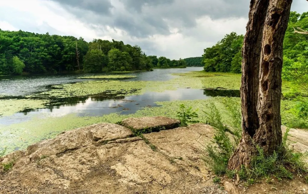
Located in good old Wawayanda State Park, this is one of many popular hikes near NYC that will actually takes you on the Appalachian Trail.
So, from the parking lot near the Appalachian Boardwalk entrance, start a tough climb to the summit of Wawayanda Mountain, by way of the Appalachian Trail.
You can also enjoy a bit of boulder hopping as you climb since there are plenty of large rocks in the area. Continue to the top for impressive views of Vernon Valley and the Catskills, making sure to visit the second overlook here before heading back down.
Then, as you descend, channel your inner bushwhacker while conquering an old section of the Appalachian Trail. Just be mindful of where you’re going since the trail here can be difficult to follow.
You’ll also pass a lovely little waterfall that you can stop at. Just be super careful since this area is notorious for having unstable rocks.
From here, follow the path right as you continue near the base of the mountain and make your way back to the Appalachian Trail.
Location: Vernon, NJ
Distance: 2.6 miles
Difficulty: Moderate
Route: Out and Back
Elevation Gain: 889 feet
Distance from NYC: 54 miles or about an hour and a half drive.
22. Ken Lockwood Gorge Trail
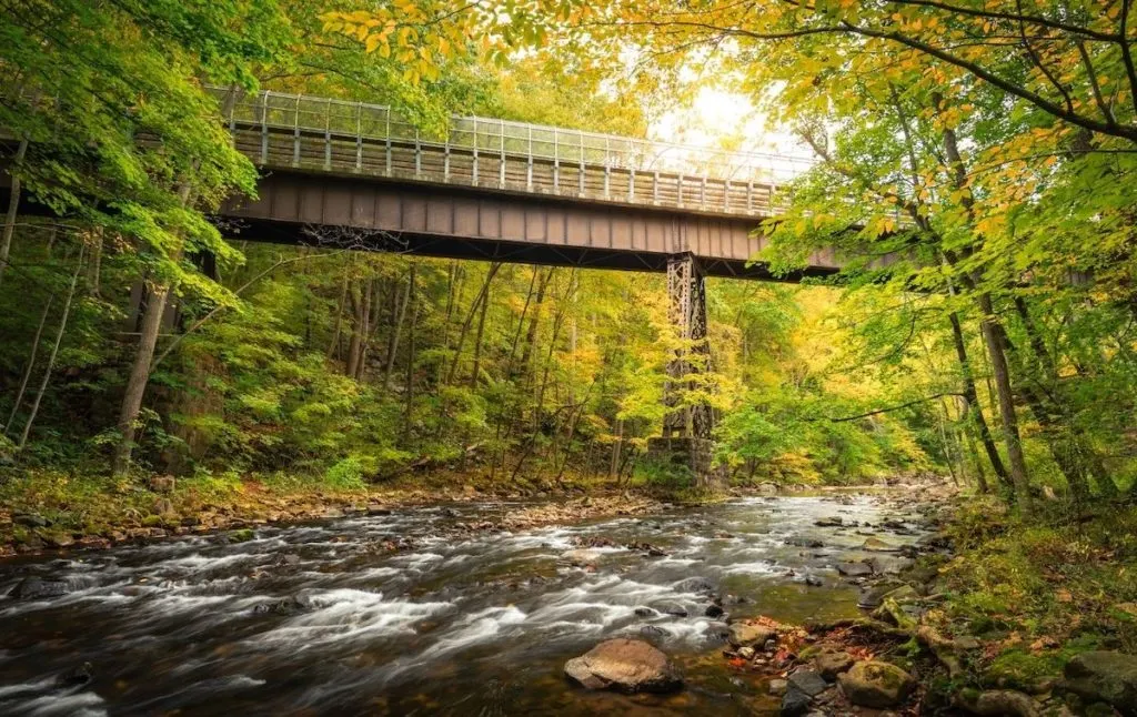
One of the best hiking trails near NYC that is accessible all year long, this short and sweet trek through the 500-acre Ken Lockwood Gorge Wildlife Management Area will take you past towering hemlocks and along the steep walls of the Ken Lockwood Gorge – walls that add to your sense of isolation and that protect you from the sun.
Other than that, just hike along this flat, rocky, unpaved road that runs parallel to the southern end of the Raritan River and experience one of the most stunning hikes in all of New Jersey.
Pro Tip: This is a pretty easy, flat hike. However, it’s not great for biking since there are lots of rocks along the path. Also, arrive early in the AM since this place is popular and parking lots are small. So, as you probably already guessed, parking spots get snatched up fast.
Location: Califon, NJ
Distance: Between 2.5 miles and. 3.8 miles
Difficulty: Easy
Route: Out and Back
Elevation Gain: 154 feet
Distance from NYC: 55 miles or an hour and ten minute drive.
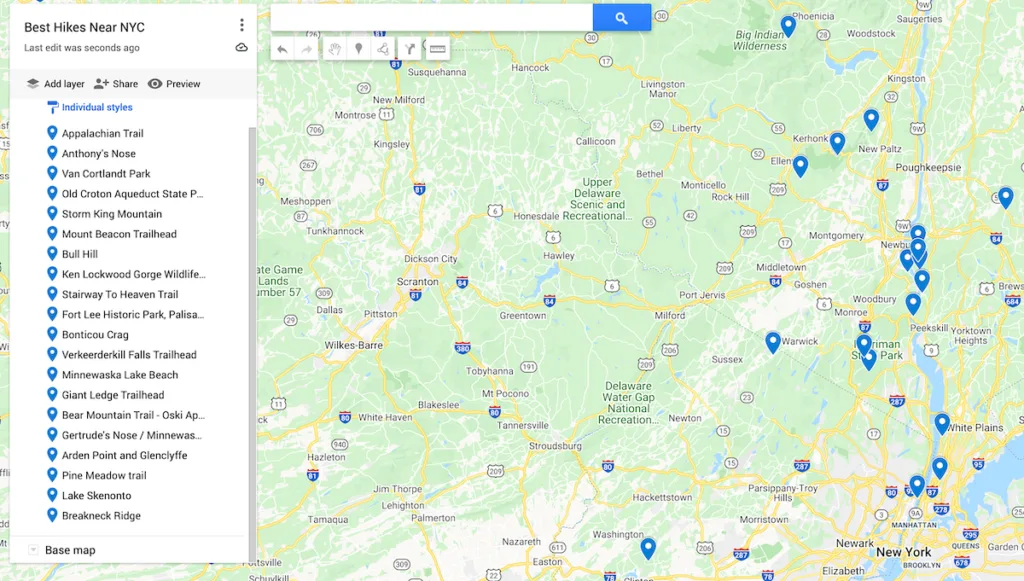
Map of the Best Hikes Near NYC
Additional New York Resources You’ll Love
- Best Hikes in the Finger Lakes
- Best Things to do in Poughkeepsie
- Best Things to do in Beacon
- Unique restaurants in NYC
- 4 days in NYC
- 2 days in New York City Itinerary
- Best Time to Visit NYC
There you have it! That just about wraps up this guide to the top hikes near New York City!
Tell me, did your picks for the best hiking trails near New York City make the list? If not then let me know in the comments below!
And if you found this post useful, don’t forget to join our email list before pinning this post now so that you can read it again later!
